
IMAGES TAKEN NEAR TO
Llwyn Eithan, CAERPHILLY, CF83 3BW
Introduction
This page details the photographs taken nearby to Llwyn Eithan, CF83 3BW by members of the Geograph project.
The Geograph project started in 2005 with the aim of publishing, organising and preserving representative images for every square kilometre of Great Britain, Ireland and the Isle of Man.

There are currently over 7.5m images from over14,400 individuals and you can help contribute to the project by visiting https://www.geograph.org.uk
Image Map
Images are licensed for reuse under creativecommons.org/licenses/by-sa/2.0
Notes
- Clicking on the map will re-center to the selected point.
- The higher the marker number, the further away the image location is from the centre of the postcode.
Image Listing (47 Images Found)
Images are licensed for reuse under creativecommons.org/licenses/by-sa/2.0
Image
Details
Distance
1
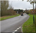
No pedestrians ahead, Caerphilly
Viewed from Rudry Road. There are no pavements ahead, along a 150 metre long road connecting with the unnamed ring road skirting the eastern edge of residential Caerphilly. The circular sign with a red edge indicates no pedestrians allowed.
Image: © Jaggery
Taken: 18 Nov 2011
0.03 miles
2
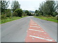
Rudry Road, Caerphilly
Rudry Road heads NE away from the unnamed ring road skirting the eastern edge of residential Caerphilly.
Image: © Jaggery
Taken: 17 Aug 2011
0.07 miles
3
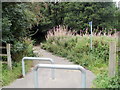
National Cycle Network Route 4, Caerphilly
Viewed across the unnamed ring road skirting the eastern edge of residential Caerphilly. A blue sign on the right points along National Cycle Network Route 4. Sturdy metal posts prevent unsuitable vehicles using the cycle route.
Image: © Jaggery
Taken: 17 Aug 2011
0.07 miles
4
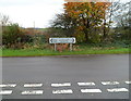
Midway between Caerphilly and Rudry
Viewed from Rudry Road, which bends to the left here. Turn right for central Caerphilly.
Distance shown is 1¼ miles to both Rudry and (central) Caerphilly.
Image: © Jaggery
Taken: 18 Nov 2011
0.07 miles
5
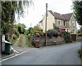
West View or Westview Terrace, Rudry Road, Caerphilly
The street name sign disagrees with maps I've consulted (not an unprecedented occurrence!). The sign, to the right of the pole, shows West View, whereas two maps show the track on the left as Westview Terrace.
Image: © Jaggery
Taken: 17 Aug 2011
0.12 miles
6
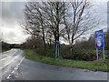
Road junction
The signposts are at the entrance to the old Rudry Road.
Image: © Alan Hughes
Taken: 17 Feb 2020
0.12 miles
7

Pen-y-cae houses, Caerphilly
Houses in the Morningtom Meadows area in the NE of Caerphilly.
Image: © Jaggery
Taken: 17 Aug 2011
0.13 miles
8
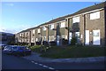
Pen-y-cae, Mornington Meadows
Part of a large housing estate, to the north of Caerphilly.
Image: © Roger Cornfoot
Taken: 19 Mar 2007
0.15 miles
9
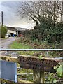
Plasnewydd Farm
Sign at entrance to Plasnewydd Farm.
Image: © Alan Hughes
Taken: 17 Feb 2020
0.15 miles
10
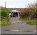
Entrance to Plas-newydd Farm, Caerphilly
Viewed from the road to Rudry. In this mid-November 2011 view, eggs were for sale at £2.40 a dozen.
Image: © Jaggery
Taken: 18 Nov 2011
0.15 miles