1
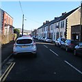
Ton-y-felin Road
Image: © Des Blenkinsopp
Taken: 20 Feb 2014
0.06 miles
2
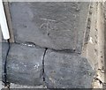
Ordnance Survey Cut Mark
This OS cut mark can be found on the Baptist Chapel, Bedwas Road. It marks a point 77.200m above mean sea level.
Image: © Adrian Dust
Taken: 20 Jul 2018
0.06 miles
3
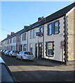
Long row of houses, Lawrence Street, Caerphilly
Extending for 120 metres along the south side of the street.
Image: © Jaggery
Taken: 17 Jan 2019
0.06 miles
4
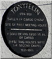
Tonyfelin plaque, Caerphilly
On the wall here. https://www.geograph.org.uk/photo/6026473 The text is in Welsh and English.
Image: © Jaggery
Taken: 17 Jan 2019
0.08 miles
5
Junction of Lawrence Street and Charles Street, Caerphilly
From the left, Charles Street joins Lawrence Street.
Image: © Jaggery
Taken: 17 Jan 2019
0.09 miles
6
Tonyfelin Welsh Baptist Chapel, Caerphilly
Located on Bedwas Road. The chapel was built in 1800 and rebuilt/modified in 1820.
Image: © Jaggery
Taken: 21 Apr 2010
0.09 miles
7
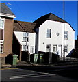
White houses, Tonyfelin Road, Caerphilly
The round plaque https://www.geograph.org.uk/photo/6026476 on the wall records the site of the first Tonyfelin Meeting House (1784-1821).
The two houses were the second chapel (1821-1866).
Image: © Jaggery
Taken: 17 Jan 2019
0.09 miles
8
Lloyds Pharmacy and Clear Sky Recruitment, 31 Ton-y-felin Rd, Caerphilly
Lloyds Pharmacy on the ground floor, Clear Sky Recruitment office on the first floor.
Image: © Jaggery
Taken: 21 Jun 2018
0.09 miles
9
On-street parking, Lawrence Street, Caerphilly
Lawrence Street is on the east side of the B4600 Pontygwindy Road.
Image: © Jaggery
Taken: 17 Jan 2019
0.10 miles
10
Caerphilly Kingdom Hall of Jehovah's Witnesses
Image: © Peter Gwenlan
Taken: 21 Feb 2008
0.10 miles


