1
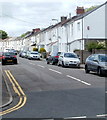
Dol-y-felin Street, Caerphilly
Houses on the north side of the street, viewed from near the corner of Pontygwindy Road (A469).
Image: © Jaggery
Taken: 19 May 2011
0.06 miles
2
Indian Valley Garden in Caerphilly
Indian takeaway at 29 Pontygwindy Road.
Image: © Jaggery
Taken: 17 Jan 2019
0.06 miles
3
Kwong Ming in Caerphilly
Chinese takeaway at 23 Pontygwindy Road.
Image: © Jaggery
Taken: 17 Jan 2019
0.07 miles
4
Mount Carmel Baptist Church, Caerphilly
Located on Pontygwindy Road (A469), viewed from the corner of Charles Street.
Mount Carmel Baptist congregation, founded in 1874, has worshipped here since 1892.
Image: © Jaggery
Taken: 19 May 2011
0.09 miles
5
Former St Ilan Comprehensive School, Caerphilly
Set back from the west side of Pontygwindy Road (A469). The school was closed in 2007, because of reducing numbers of students enrolled. Some maps show the buildings now as 'Television Studios' but the sign on the left of the view shows 'Community Education Centre'.
Image: © Jaggery
Taken: 19 May 2011
0.11 miles
6
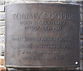
Tommy Cooper
Tommy Cooper, plaque on the base of the statue. Another proud Welshman.
Image: © RAY JONES
Taken: 29 Aug 2009
0.11 miles
7
West stand and Cafe Verde, Virginia Park, Caerphilly
Virginia Park is the home ground of Caerphilly RFC (rugby football club). In view of the colour of the buildings, it is no surprise that Caerphilly RFC play in green shirts.
Image: © Jaggery
Taken: 19 May 2011
0.12 miles
8
Clubhouse, Virginia Park, Caerphilly
Located on the west side of Virginia Park rugby ground, http://www.geograph.org.uk/photo/2416288 the home venue of Caerphilly RFC.
The ground is on the east side of Pontygwindy Road (A469).
Image: © Jaggery
Taken: 19 May 2011
0.12 miles
9
Vets4Pets, Piccadilly Square, Caerphilly
Located between Pontygwindy Road (camera side) and Mill Road.
Other names in view in January 2019 are The Groom Room and Domino's Pizza.
Image: © Jaggery
Taken: 17 Jan 2019
0.12 miles
10
Charles Street, Caerphilly
On the northwest side of Lawrence Street.
Image: © Jaggery
Taken: 17 Jan 2019
0.14 miles


