1
New Street, Pwllypant, Caerphilly
Houses on the west side of the street, viewed from Central Street.
Image: © Jaggery
Taken: 19 May 2011
0.09 miles
2
Coed Leddyn, Pwllypant
Image: © John Lord
Taken: 20 Oct 2017
0.10 miles
3
12% gradient ahead, Wilkins Terrace, Pwllypant, Caerphilly
The sign shows a steep (1 in 8.5) climb ahead, from Pwllypant to Energlyn.
Image: © Jaggery
Taken: 19 May 2011
0.11 miles
4
Pwllypant railway bridge
The bridge carries a two-track railway line over the road from Pwllypant to Energlyn. The bridge is between Aber and Llanbradach railway stations, on the Rhymney Line of the Valley Lines network.
The headroom show is 15ft 9in (4.8 metres). Vehicles heading uphill have priority over descending vehicles along the briefly narrower roadway under the bridge.
Image: © Jaggery
Taken: 19 May 2011
0.11 miles
5
Steps up to Central Street houses, Pwllypant, Caerphilly
Viewed from the edge of a remnant http://www.geograph.org.uk/photo/2416613 of Llanbradach railway viaduct.
Image: © Jaggery
Taken: 19 May 2011
0.12 miles
6
Central Street, Pwllypant, Caerphilly
Houses on the west side of the street. Towering in the distance is a disconnected arch, http://www.geograph.org.uk/photo/2416613 formerly part of Llanbradach railway viaduct.
Image: © Jaggery
Taken: 19 May 2011
0.12 miles
7
Railway bridge over Heol Pwllypant, Pwllypant
Image: © John Lord
Taken: 20 Oct 2017
0.12 miles
8
A468 passes under railway near Pwllypant
Image: © Colin Pyle
Taken: 17 Dec 2013
0.13 miles
9
Pwllypant
Heol Pwllypant passes beneath the Caerphilly to Merthyr line.
Image: © Roger Cornfoot
Taken: 19 Mar 2007
0.14 miles
10
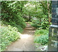
Track into the woods, Pwllypant, Caerphilly
On the north side of a remnant http://www.geograph.org.uk/photo/2416613 of Llanbradach railway viaduct, a track heads into woodland.
Image: © Jaggery
Taken: 19 May 2011
0.14 miles


