
IMAGES TAKEN NEAR TO
Raglan Court, CAERPHILLY, CF83 2TF
Introduction
This page details the photographs taken nearby to Raglan Court, CF83 2TF by members of the Geograph project.
The Geograph project started in 2005 with the aim of publishing, organising and preserving representative images for every square kilometre of Great Britain, Ireland and the Isle of Man.

There are currently over 7.5m images from over14,400 individuals and you can help contribute to the project by visiting https://www.geograph.org.uk
Image Map
Images are licensed for reuse under creativecommons.org/licenses/by-sa/2.0
Notes
- Clicking on the map will re-center to the selected point.
- The higher the marker number, the further away the image location is from the centre of the postcode.
Image Listing (44 Images Found)
Images are licensed for reuse under creativecommons.org/licenses/by-sa/2.0
Image
Details
Distance
1
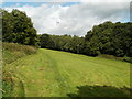
Field alongside Hendredenny Drive, Caerphilly
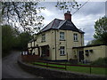
Viewed from the car park of The Angel pub. http://www.geograph.org.uk/photo/2569822
A lamp post on Hendredenny Drive can be seen in the middle of the view.
Image: © Jaggery
Taken: 25 Aug 2011
0.04 miles
2
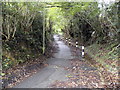
Path from The Angel to Hendredenny Park, Caerphilly
Shown on maps as Groeswen Road, this is only a path. The Angel pub http://www.geograph.org.uk/photo/2569822 is behind the camera.
The black and white posts line a small drainage channel.
Image: © Jaggery
Taken: 25 Aug 2011
0.05 miles
3
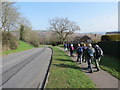
Heol Groeswen Drive
Cerddwyr yn dilyn Heol Groeswen ym Mharc Hendredenny.
Walkers following Groeswen Drive (trans. White cross) in Hendredenny Park.
Image: © Alan Richards
Taken: 30 Mar 2014
0.06 miles
4
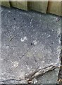
Ordnance Survey Rivet
This OS rivet can be found on the wall of the Angel Inn. It marks a point 118.528m above mean sea level.
Image: © Adrian Dust
Taken: 20 Jul 2018
0.07 miles
6
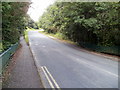
Hendredenny Drive passes over Nant-yr-aber, Caerphilly
The dark green railings on each side of the road are on the bridge carrying the road over a brook. http://www.geograph.org.uk/photo/2569881
Image: © Jaggery
Taken: 25 Aug 2011
0.08 miles
7
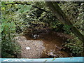
Nant-yr-aber flows away from Hendredenny Drive, Caerphilly
The brook is a tributary of the Rhymney. A few tens of metres behind the camera, Nant-yr-aber flowed past the SW edge of Brookside Close.
Image: © Jaggery
Taken: 25 Aug 2011
0.08 miles
8
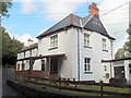
The Angel, Caerphilly
Pub at the far (western) end of White Cross Lane, about 100 metres from St Cenydd Road (B4263).
Image: © Jaggery
Taken: 25 Aug 2011
0.08 miles
9
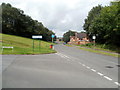
Corner of Groeswen Drive and Hendredenny Drive, Caerphilly
Groeswen Drive on the left leads to roads in the southern half of Hendredenny Park; Hendredenny Drive leads to roads in the northern half. There are no other connecting roads between the two halves, so drivers taking the wrong road need to return to this point for the right road.
Image: © Jaggery
Taken: 25 Aug 2011
0.09 miles
10
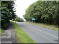
Hendredenny Drive reaches Hendredenny
Hendredenny is a suburb at the western edge of Caerphilly. Viewed from near the St Cenydd Road (B4263) end of the drive.
Image: © Jaggery
Taken: 25 Aug 2011
0.09 miles