
IMAGES TAKEN NEAR TO
New Street, CAERPHILLY, CF83 2NN
Introduction
This page details the photographs taken nearby to New Street, CF83 2NN by members of the Geograph project.
The Geograph project started in 2005 with the aim of publishing, organising and preserving representative images for every square kilometre of Great Britain, Ireland and the Isle of Man.

There are currently over 7.5m images from over14,400 individuals and you can help contribute to the project by visiting https://www.geograph.org.uk
Image Map
Images are licensed for reuse under creativecommons.org/licenses/by-sa/2.0
Notes
- Clicking on the map will re-center to the selected point.
- The higher the marker number, the further away the image location is from the centre of the postcode.
Image Listing (33 Images Found)
Images are licensed for reuse under creativecommons.org/licenses/by-sa/2.0
Image
Details
Distance
1
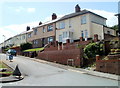
New Street, Pwllypant, Caerphilly
Houses on the west side of the street, viewed from Central Street.
Image: © Jaggery
Taken: 19 May 2011
0.03 miles
2
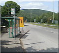
Mountain View bus stop, Caerphilly
The bus stop, on the A469, is named for the adjacent street, but the stop also has its own view of a mountain, or maybe it's only a hill.
Image: © Jaggery
Taken: 19 May 2011
0.04 miles
3
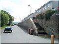
Steps up to Central Street houses, Pwllypant, Caerphilly
Viewed from the edge of a remnant http://www.geograph.org.uk/photo/2416613 of Llanbradach railway viaduct.
Image: © Jaggery
Taken: 19 May 2011
0.05 miles
4
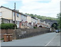
Central Street, Pwllypant, Caerphilly
Houses on the west side of the street. Towering in the distance is a disconnected arch, http://www.geograph.org.uk/photo/2416613 formerly part of Llanbradach railway viaduct.
Image: © Jaggery
Taken: 19 May 2011
0.05 miles
5
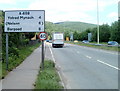
A469 heads towards Llanbradach turning
The A road heads NW away from Caerphilly. Strangely, the village of Llanbradach, population about 4,600, is not shown on the sign. Perhaps it's because Llanbradach is not on the A469, but is reached along a turning from it.
Image: © Jaggery
Taken: 19 May 2011
0.06 miles
6
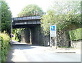
Pwllypant railway bridge
The bridge carries a two-track railway line over the road from Pwllypant to Energlyn. The bridge is between Aber and Llanbradach railway stations, on the Rhymney Line of the Valley Lines network.
The headroom show is 15ft 9in (4.8 metres). Vehicles heading uphill have priority over descending vehicles along the briefly narrower roadway under the bridge.
Image: © Jaggery
Taken: 19 May 2011
0.08 miles
7
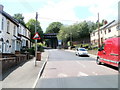
12% gradient ahead, Wilkins Terrace, Pwllypant, Caerphilly
The sign shows a steep (1 in 8.5) climb ahead, from Pwllypant to Energlyn.
Image: © Jaggery
Taken: 19 May 2011
0.08 miles
8
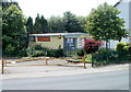
Pwllypant Village Store, Caerphilly
Single-storey building on Wilkins Terrace, formerly housing Pwllypant Post Office, which closed in 2004.
The two items I bought in the shop were not priced. There was no barcode scanner in the shop, so the assistant (who was 'minding the shop' during lunch time), phoned the owner to find out the price of the items. It might have apt if he had used an old-style candlestick phone, but no, it was a mobile phone.
Image: © Jaggery
Taken: 19 May 2011
0.08 miles
9
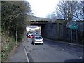
Pwllypant
Heol Pwllypant passes beneath the Caerphilly to Merthyr line.
Image: © Roger Cornfoot
Taken: 19 Mar 2007
0.09 miles
10
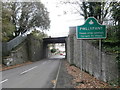
Railway bridge over Heol Pwllypant, Pwllypant
Image: © John Lord
Taken: 20 Oct 2017
0.09 miles