
IMAGES TAKEN NEAR TO
Y Dolydd, CAERPHILLY, CF83 1NT
Introduction
This page details the photographs taken nearby to Y Dolydd, CF83 1NT by members of the Geograph project.
The Geograph project started in 2005 with the aim of publishing, organising and preserving representative images for every square kilometre of Great Britain, Ireland and the Isle of Man.

There are currently over 7.5m images from over14,400 individuals and you can help contribute to the project by visiting https://www.geograph.org.uk
Image Map
Images are licensed for reuse under creativecommons.org/licenses/by-sa/2.0
Notes
- Clicking on the map will re-center to the selected point.
- The higher the marker number, the further away the image location is from the centre of the postcode.
Image Listing (32 Images Found)
Images are licensed for reuse under creativecommons.org/licenses/by-sa/2.0
Image
Details
Distance
1
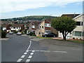
Y Dolydd houses, Caerphilly
Houses on the northern side of a cul-de-sac, Y Dolydd, viewed from the corner of Plas Grug.
Image: © Jaggery
Taken: 19 Aug 2011
0.03 miles
2
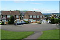
Plas Grug houses, Caerphilly
Houses in a cul-de-sac in the Watford Park area of SE Caerphilly.
Image: © Jaggery
Taken: 19 Aug 2011
0.06 miles
3
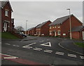
Beech Tree Avenue, Caerphilly
Cul-de-sac of houses built in the second decade of the 21st century on the west side of Watford Road.
Image: © Jaggery
Taken: 11 Jan 2019
0.09 miles
4
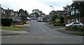
Watford Close, Caerphilly
Houses in the Watford Park area of SE Caerphilly, view from Heol Waun Waelod.
Image: © Jaggery
Taken: 19 Aug 2011
0.10 miles
5
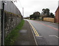
Watford Road, Caerphilly
Watford Road ascends southwards towards the Watford Park area of Caerphilly.
Image: © Jaggery
Taken: 11 Jan 2019
0.10 miles
6
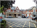
Entrance to Caerphilly District Miners' Hospital
The entrance is at the northern end of Watford Road, Caerphilly, opposite the St Martin's Road junction. Caerphilly District Miners’ Hospital was built in 1923 to provide health care for the miners who worked in the pits of the Rhymney Valley, and for their families. It is now an NHS hospital, administered by Aneurin Bevan Health Board. The Board was formed on October 1st 2009 by the merger of the Blaenau, Caerphilly, Monmouthshire, Newport and Torfaen Local Health Boards, and Gwent Healthcare NHS Trust.
Image: © Jaggery
Taken: 19 Aug 2011
0.11 miles
7
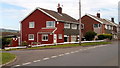
Corner of St Teilo's Way and St David's Way, Caerphilly
Houses in the Watford Park area of SE Caerphilly.
Image: © Jaggery
Taken: 19 Aug 2011
0.11 miles
8
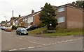
St David's Way, Watford Park, Caerphilly
The large Watford Farm Estate sign shows that streets in this part of Watford Park, SE Caerphilly, are named after Welsh saints - David, Teilo, Asaph and Ilan.
Image: © Jaggery
Taken: 19 Aug 2011
0.11 miles
9
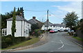
Bryngwyn houses, Caerphilly
Houses on the north side of a road named Bryngwyn, viewed from Watford Road.
Image: © Jaggery
Taken: 19 Aug 2011
0.11 miles
10
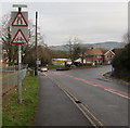
Warning signs, Watford Road, Caerphilly
Near the northern end of Watford Road, on the approach to the St Martin's Road/Lon-y-llyn junction.
Image: © Jaggery
Taken: 11 Jan 2019
0.14 miles