1
St David's Way, Watford Park, Caerphilly
The large Watford Farm Estate sign shows that streets in this part of Watford Park, SE Caerphilly, are named after Welsh saints - David, Teilo, Asaph and Ilan.
Image: © Jaggery
Taken: 19 Aug 2011
0.01 miles
2
Corner of St Teilo's Way and St David's Way, Caerphilly
Houses in the Watford Park area of SE Caerphilly.
Image: © Jaggery
Taken: 19 Aug 2011
0.01 miles
3
Watford Road, Caerphilly
Watford Road ascends southwards towards the Watford Park area of Caerphilly.
Image: © Jaggery
Taken: 11 Jan 2019
0.03 miles
4
Bryngwyn houses, Caerphilly
Houses on the north side of a road named Bryngwyn, viewed from Watford Road.
Image: © Jaggery
Taken: 19 Aug 2011
0.06 miles
5
Plas Grug houses, Caerphilly
Houses in a cul-de-sac in the Watford Park area of SE Caerphilly.
Image: © Jaggery
Taken: 19 Aug 2011
0.08 miles
6
Watford Close, Caerphilly
Houses in the Watford Park area of SE Caerphilly, view from Heol Waun Waelod.
Image: © Jaggery
Taken: 19 Aug 2011
0.08 miles
7
Beech Tree Avenue, Caerphilly
Cul-de-sac of houses built in the second decade of the 21st century on the west side of Watford Road.
Image: © Jaggery
Taken: 11 Jan 2019
0.09 miles
8
Y Dolydd houses, Caerphilly
Houses on the northern side of a cul-de-sac, Y Dolydd, viewed from the corner of Plas Grug.
Image: © Jaggery
Taken: 19 Aug 2011
0.11 miles
9
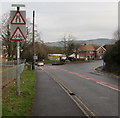
Warning signs, Watford Road, Caerphilly
Near the northern end of Watford Road, on the approach to the St Martin's Road/Lon-y-llyn junction.
Image: © Jaggery
Taken: 11 Jan 2019
0.12 miles
10
St Martin's Store, Caerphilly
A Premier store at 115 St Martin's Road, on the corner of Lon-y-llyn opposite Caerphilly District Miners' Hospital http://www.geograph.org.uk/photo/2723051
Image: © Jaggery
Taken: 19 Aug 2011
0.12 miles


