1
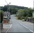
Mountain Road, Caerphilly
Mountain Road heads SSE in the direction of the high ground of Caerphilly Common.
The two left turns ahead are for Corbett Crescent and Warren Drive. The houses on the right at the bend in the distance are at the corner of Ffordd Deg. http://www.geograph.org.uk/photo/2561634
Image: © Jaggery
Taken: 19 Aug 2011
0.07 miles
2
Corner of Mountain Road and Warren Drive, Caerphilly
Viewed across Mountain Road. http://www.geograph.org.uk/photo/2561612 to a closeup view of the Edward VII postbox.
Image: © Jaggery
Taken: 19 Aug 2011
0.07 miles
3
Edward VII postbox, corner of Mountain Road and Warren Drive, Caerphilly
The postbox is at this http://www.geograph.org.uk/photo/2561606 junction.
The Edward VII monogram dates the box to between 1901 and 1910.
Image: © Jaggery
Taken: 19 Aug 2011
0.07 miles
4
Corner of Mountain Road and Ffordd Deg, Caerphilly
Ffordd Deg http://www.geograph.org.uk/photo/2561634 houses viewed across Mountain Road.
Image: © Jaggery
Taken: 19 Aug 2011
0.07 miles
5
Ffordd Deg, Caerphilly
Houses in a short cul-de-sac on the SW side of Mountain Road.
Image: © Jaggery
Taken: 19 Aug 2011
0.07 miles
6
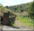
Track from Mountain Road, Caerphilly into woodland
The track runs along the southern edge of a derelict house. http://www.geograph.org.uk/photo/2561784
Image: © Jaggery
Taken: 19 Aug 2011
0.11 miles
7
Boarded-up house, Mountain Road, Caerphilly
The fenced-off site is on the east side of Mountain Road. This is (or was) the most southerly house on Mountain Road, which continues its ascent, beyond the right edge of the view, towards Caerphilly Common.
The gate at the right edge of the view leads to a track http://www.geograph.org.uk/photo/2561797 into woodland.
Image: © Jaggery
Taken: 19 Aug 2011
0.13 miles
8
End of the 30mph speed limit, Mountain Road, Caerphilly
On its long ascent towards the high ground of Caerphilly Common, Mountain Road leaves the 30mph speed limit zone and enters the National Speed Limit zone.
Image: © Jaggery
Taken: 19 Aug 2011
0.13 miles
9
Overgrown track viewed from Mountain Road, Caerphilly
A track heading SW away from Mountain Road is overgrown with weeds within a few metres of the roadway.
Image: © Jaggery
Taken: 19 Aug 2011
0.13 miles
10
Keep in low gear : 17% descent ahead, Mountain Road, Caerphilly
Having just walked up Mountain Road to this point, I can confirm it is a steep climb up from Caerphilly railway and bus stations! The sign shows a 1.7% descent ahead, but 17% is intended - that's a 1 in 6 gradient. A 1.7% gradient would be barely noticeable, and would certainly not need a sign!
Image: © Jaggery
Taken: 19 Aug 2011
0.13 miles


