1
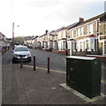
West side of Ludlow Street, Caerphilly
Houses on the west side of Ludlow Street viewed looking north from the corner of Pentrebane Street.
The broken white lines on the left are at the Claude Road junction.
Image: © Jaggery
Taken: 10 Jan 2019
0.01 miles
2
Dark green cabinet on a Caerphilly corner
The telecoms cabinet is on the corner of Ludlow Street and Stockland Street, opposite Florence Grove.
Image: © Jaggery
Taken: 8 Jan 2019
0.01 miles
3
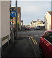
Down Ludlow Street, Caerphilly
From the corner of Claude Road, Ludlow Street descends northwards towards Stockland Street and Florence Grove. The No Entry sign is at the Pentrebane Street junction.
Image: © Jaggery
Taken: 10 Jan 2019
0.01 miles
4
Row of houses, Ludlow Street, Caerphilly
This part of Ludlow Street is between Florence Grove and Claude Road.
Image: © Jaggery
Taken: 8 Jan 2019
0.03 miles
5
Ordnance Survey Cut Mark
This OS cut mark can be found on No53 Ludlow Street. It marks a point 96.174m above mean sea level.
Image: © Adrian Dust
Taken: 20 Jul 2018
0.03 miles
6
Bradford Street north of Pentrebane Street, Caerphilly
This part of Bradford Street is between the Pentrebane Street intersection and the Stockland Street intersection.
Image: © Jaggery
Taken: 10 Jan 2019
0.04 miles
7
Elim Pentecostal Church, Caerphilly
The St Fagans Street side of the church on the corner of Crescent Road.
Image: © Jaggery
Taken: 10 Jan 2019
0.04 miles
8
Information board for Elim Pentecostal Church, Caerphilly
On display on the wall here https://www.geograph.org.uk/photo/6022901 on January 10th 2019.
Image: © Jaggery
Taken: 10 Jan 2019
0.04 miles
9
Mandatory left turn sign, Stockland Street, Caerphilly
Vehicles must turn left here into Bradford Street.
Image: © Jaggery
Taken: 8 Jan 2019
0.04 miles
10
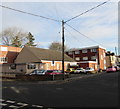
Wires over a Caerphilly corner
Wires radiate from a wooden pole on the corner of Crescent Road and St Fagans Street.
Image: © Jaggery
Taken: 8 Jan 2019
0.04 miles


