1
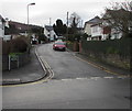
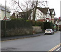
Redbrook Court, Caerphilly
Redbrook Court is a cul-de-sac on the south side of St Martin's Road.
Image: © Jaggery
Taken: 6 May 2011
0.06 miles
2
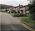
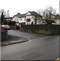
St Martin's Crescent, Caerphilly
Cul-de-sac on the south side of St Martin's Road.
Image: © Jaggery
Taken: 11 Jan 2019
0.06 miles
3
West side of Redbrook Court, Caerphilly
Redbrook Court is a cul-de-sac on the south side of St Martin's Road.
Image: © Jaggery
Taken: 11 Jan 2019
0.07 miles
4
Glan Nant Close, Caerphilly
Cul-de-sac on the south side of St Martin's Road. The brook Nant Ddu is nearby.
Image: © Jaggery
Taken: 11 Jan 2019
0.08 miles
5
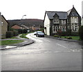
House on the corner of St Martin's Road and Clos Glan Nant, Caerphilly
Clos Glan Nant heads away from St Martin's Road past a detached stone-built house.
Image: © Jaggery
Taken: 6 May 2011
0.08 miles
6
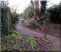
Path ascending from the south side of St Martin's Road, Caerphilly
Towards houses in Watford Rise.
Image: © Jaggery
Taken: 11 Jan 2019
0.08 miles
7
Warning sign - elderly people, St Martin's Road, Caerphilly
Near the corner of St Martin's Crescent.
Image: © Jaggery
Taken: 11 Jan 2019
0.08 miles
8
Junction of St Martin's Crescent and St Martin's Road, Caerphilly
St Martin's Crescent from the left joins St Martin's Road.
Image: © Jaggery
Taken: 11 Jan 2019
0.09 miles
9
Redbrook Court in Caerphilly
The houses at the far end of this cul-de-sac on the south side of St Martin's Road are at the edge of a golf course.
Image: © Jaggery
Taken: 11 Jan 2019
0.09 miles
10
Red Brook electricity substation, Caerphilly
Located here https://www.geograph.org.uk/photo/6021921 on the corner of St Martin's Road and Glan Nant Close, the large cabinet is a Western Power Distribution electricity substation. Its identifier is RED BROOK CAERPHILLY S/S 542331
Image: © Jaggery
Taken: 11 Jan 2019
0.09 miles


