1
Railway bridge, Caerphilly
Footpath and National Cycle Network route 4 pass beneath the Cardiff-Rhymney line near Caerphilly.
Image: © Gareth James
Taken: 30 May 2010
0.07 miles
2
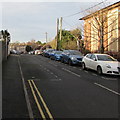
Long row of lockup garages, Florence Grove, Caerphilly
Extending for about 100 metres along the north side of Florence Grove.
Image: © Jaggery
Taken: 8 Jan 2019
0.10 miles
3
Class 37 near Aber
Class 37 No. 37418 brings up the rear of a Rhymney to Cardiff Canton training run as it leaves Aber station; next stop Caerphilly.
Image: © Gareth James
Taken: 5 Jun 2019
0.12 miles
4
West along Claude Road, Caerphilly
From the corner of Ludlow Street. Wesley Methodist Church https://www.geograph.org.uk/photo/6042027 is on the right.
Image: © Jaggery
Taken: 8 Jan 2019
0.13 miles
5
Southeast end of Aber station, Caerphilly
The view from Aber railway station looking in the direction of Caerphilly station.
Aber station is on the Rhymney Line, 13 km (8¼ miles) north of Cardiff Central on the Valley Lines network. Opened as Beddau Halt in April 1908 by the Rhymney Railway,it became part of the Great Western Railway at the Grouping (1923).
It was renamed Aber Junction Halt in 1926, Aber Halt in 1968, and Aber in 1969.
Image: © Jaggery
Taken: 21 Apr 2010
0.13 miles
6
Castle View, Claude Road, Denscombe, Caerphilly
Castle View residential care home is owned by Caerphilly County Borough Council.
Image: © Jaggery
Taken: 10 Jan 2019
0.14 miles
7
Tŷ Siriol, St Martin's Road, Caerphilly
In January 2019 the National Health Service nameboard shows
South Caerphilly Borough Community Mental Health and the Welsh equivalent.
Image: © Jaggery
Taken: 11 Jan 2019
0.15 miles
8
St Martin's House, St Martin's Road, Caerphilly
In January 2019 the nameboard shows St Martin's House - Abbeyfield Independent Living.
Image: © Jaggery
Taken: 11 Jan 2019
0.15 miles
9
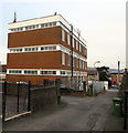
Caerphilly Exchange
Located between Claude Road and Florence Grove (ahead), Caerphilly Exchange provides broadband and telephone services for about 18,700 residential premises and 730 non-residential premises. The exchange identifier code is SWCAB.
Image: © Jaggery
Taken: 10 Jan 2019
0.16 miles
10
Florence Grove side of Caerphilly Exchange
Caerphilly Exchange provides broadband and telephone services for about 18,700 residential premises and 730 non-residential premises. The exchange identifier code is SWCAB.
Image: © Jaggery
Taken: 8 Jan 2019
0.16 miles


