1
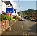
Bronrhiw Avenue, Caerphilly
Bronrhiw Avenue heads away from King Edward Avenue, close to the railway station and bus station.
Image: © Jaggery
Taken: 7 May 2010
0.03 miles
2
Jehu Group building site, Mountain Road, Caerphilly
Viewed on December 20th 2018. The Jehu Group is a third generation family-owned business.
Its three wholly-owned subsidiaries are Jehu Project Services, Waterstone Homes and Waterstone Estates.
Image: © Jaggery
Taken: 20 Dec 2018
0.04 miles
3
Caerphilly Magistrates' Court
Set back from the east side of Mountain Road, a few tens of metres from Caerphilly Police Station. http://www.geograph.org.uk/photo/2561503
Image: © Jaggery
Taken: 19 Aug 2011
0.05 miles
4
Prince's Avenue, Caerphilly
Looking south from the corner of King Edward Avenue.
The postbox http://www.geograph.org.uk/photo/1850431 in the wall is from the reign of King Edward VII (1901-1910).
Image: © Jaggery
Taken: 7 May 2010
0.05 miles
5
The Mount car park, Mountain Road, Caerphilly
In December 2018 the nameboard shows Youth Intervention Team, The Mount, Mountain Road, Caerphilly.
The text is also in Welsh.
Image: © Jaggery
Taken: 20 Dec 2018
0.05 miles
6
Welcome to Caerphilly Golf Club
On the right here. https://www.geograph.org.uk/photo/6005492 The green board shows that the club was founded in 1905. Visitors welcome - membership available. The nearer board shows Wedding Venue - also Function Room Available.
Image: © Jaggery
Taken: 20 Dec 2018
0.05 miles
7
NYAS office, Mountain Road, Caerphilly
NYAS is the acronym of the National Youth Advocacy Service.
Image: © Jaggery
Taken: 20 Dec 2018
0.06 miles
8
Hillside corner house, Caerphilly
Mountain Road side of the house on the corner of Hillside in the southeast of Caerphilly.
Image: © Jaggery
Taken: 20 Dec 2018
0.06 miles
9
Ordnance Survey Cut Mark
This OS cut mark can be found on the wall west side of Mountain Road. It marks a point 122.658m above mean sea level.
Image: © Adrian Dust
Taken: 20 Jul 2018
0.06 miles
10
Bronrhiw Fach, Caerphilly
Bronrhiw Fach is a cul-de-sac on the east side of Mountain Road.
Image: © Jaggery
Taken: 20 Dec 2018
0.07 miles


