
IMAGES TAKEN NEAR TO
Ramson Close, HENGOED, CF82 8LB
Introduction
This page details the photographs taken nearby to Ramson Close, CF82 8LB by members of the Geograph project.
The Geograph project started in 2005 with the aim of publishing, organising and preserving representative images for every square kilometre of Great Britain, Ireland and the Isle of Man.

There are currently over 7.5m images from over14,400 individuals and you can help contribute to the project by visiting https://www.geograph.org.uk
Image Map
Images are licensed for reuse under creativecommons.org/licenses/by-sa/2.0
Notes
- Clicking on the map will re-center to the selected point.
- The higher the marker number, the further away the image location is from the centre of the postcode.
Image Listing (46 Images Found)
Images are licensed for reuse under creativecommons.org/licenses/by-sa/2.0
Image
Details
Distance
1
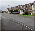
West side of Sorrel Drive, Penpedairheol
Sorrel Drive is set back about 50 metres from the west side of Hengoed Road.
Image: © Jaggery
Taken: 22 Aug 2019
0.05 miles
2
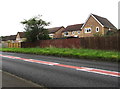
Houses on the east side of Sorrel Drive, Penpedairheol
Fencing and the backs of houses viewed across Hengoed Road.
Image: © Jaggery
Taken: 22 Aug 2019
0.07 miles
3
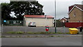
Allotments building and car park, Sorrel Drive, Penpedairheol
Allotments are behind the building. A notice states Parking for members only.
Image: © Jaggery
Taken: 22 Aug 2019
0.08 miles
4
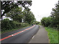
North along Hengoed Road towards Penpedairheol
The road from Cefn Hengoed approaches the southern edge of Penpedairheol, a village in Caerphilly County Borough.
Image: © Jaggery
Taken: 22 Aug 2019
0.08 miles
5
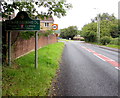
Penpedairheol - Please Drive Carefully
Hengoed Road from Cefn Hengoed reaches the southern edge of Penpedairheol, a village in Caerphilly County Borough. A literal translation of the name is the top, head or end of four roads.
Image: © Jaggery
Taken: 22 Aug 2019
0.08 miles
6
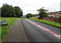
Roadside bench south of Penpedairheol
Alongside Hengoed Road between Penpedairheol and Cefn Hengoed (ahead).
Image: © Jaggery
Taken: 22 Aug 2019
0.08 miles
7
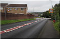
Start of the 30 zone at the southern edge of Penpedairheol
The 40mph speed limit on Hengoed Road from Cefn Hengoed drops to 30mph.
The Penpedairheol boundary sign is near the camera.
Image: © Jaggery
Taken: 22 Aug 2019
0.08 miles
8
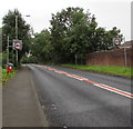
From 30 to 40 on Hengoed Road, Penpedairheol
The 30mph speed limit through Penpedairheol increases to 40mph.
The grey back of the Penpedairheol boundary sign is near the wall on the right.
Ahead for Cefn Hengoed and Hengoed.
Image: © Jaggery
Taken: 22 Aug 2019
0.08 miles
9
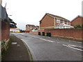
Sorrel Drive, Penpedairheol
Viewed from the corner of Hengoed Road. The sign on the left shows that
Sorrel Drive leads to Ramson Close, Burnet Drive, Downey Grove, Tansy Close.
Image: © Jaggery
Taken: 22 Aug 2019
0.09 miles
10
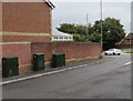
Three dark green cabinets, Sorrel Drive, Penpedairheol
Telecoms cabinets viewed in August 2019. Only one cabinet was here in an August 2011 Google Street View.
Image: © Jaggery
Taken: 22 Aug 2019
0.10 miles