1
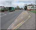
Tir-y-berth Street, Tir-y-berth
Ascending from Beatty Street towards the A469 New Road.
Image: © Jaggery
Taken: 26 Apr 2018
0.01 miles
2
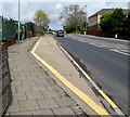
New Road bus stop and shelter, Tir-y-berth
On the east side of the A469 New Road viewed from the corner of Beatty Street.
Image: © Jaggery
Taken: 26 Apr 2018
0.02 miles
3
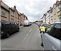
Steep ascent, Duffryn Street, Tir-y-berth
Duffryn Street ascends from Beatty Street toward Horner Street.
Image: © Jaggery
Taken: 26 Apr 2018
0.03 miles
4
Bus stop and shelter on the west side of New Road, Tir-y-berth
This stop for buses to Bargoed.
Image: © Jaggery
Taken: 26 Apr 2018
0.03 miles
5
No Entry signs, Beatty Street, Tir-y-berth
Two-way Beatty Street on the camera side becomes one-way to the A469 junction 80 metres ahead.
Image: © Jaggery
Taken: 26 Apr 2018
0.04 miles
6
Anaddas i gerbydau hir/Unsuitable for long vehicles, Beatty Street, Tir-y-berth
The Welsh/English sign faces the A469 New Road at the western end of Beatty Street.
Image: © Jaggery
Taken: 26 Apr 2018
0.04 miles
7
Two rows of houses, Beatty Street, Tir-y-berth
Viewed from the corner of the A469 New Road.
Image: © Jaggery
Taken: 26 Apr 2018
0.04 miles
8
Junction of the A469 New Road and Beatty Street, Tir-y-berth
Signs facing New Road show that Beatty Street is one way and unsuitable for long vehicles. https://www.geograph.org.uk/photo/5805289
Image: © Jaggery
Taken: 26 Apr 2018
0.04 miles
9
Allotments at Tir-y-Berth
Image: © Alan Hughes
Taken: 24 Feb 2024
0.05 miles
10
Busy Bees Day Care & Wraparound, Tir-y-berth Primary School
This is the Horner Street side of Tir-y-berth Primary School, to which the main entrance is from New Road. Busy Bees Day Care & Wraparound is a playgroup and wraparound for children aged from 2 up to school age.
The use of wraparound in this context dates from 2000, when the govermnent announced the Wraparound Pilot Programme, raising the quality of early years provision for children, and at the same time attracting more parents back into the labour market by providing more flexible care wrapped around an early education place for their young child or children.
Image: © Jaggery
Taken: 3 May 2013
0.05 miles


