
IMAGES TAKEN NEAR TO
Pengam Road, HENGOED, CF82 8AB
Introduction
This page details the photographs taken nearby to Pengam Road, CF82 8AB by members of the Geograph project.
The Geograph project started in 2005 with the aim of publishing, organising and preserving representative images for every square kilometre of Great Britain, Ireland and the Isle of Man.

There are currently over 7.5m images from over14,400 individuals and you can help contribute to the project by visiting https://www.geograph.org.uk
Image Map
Images are licensed for reuse under creativecommons.org/licenses/by-sa/2.0
Notes
- Clicking on the map will re-center to the selected point.
- The higher the marker number, the further away the image location is from the centre of the postcode.
Image Listing (97 Images Found)
Images are licensed for reuse under creativecommons.org/licenses/by-sa/2.0
Image
Details
Distance
1
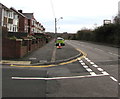
East along Pengam Road, Ystrad Mynach
Viewed from the Davies Street junction. Ahead for the A469.
Image: © Jaggery
Taken: 10 Dec 2018
0.02 miles
2
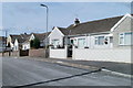
Bungalows, The Avenue, Ystrad Mynach
Bungalows of the north side of The Avenue, near the turning for Avenue Close. http://www.geograph.org.uk/photo/2036140
Image: © Jaggery
Taken: 27 Aug 2010
0.04 miles
3
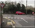
Ildiwch/Give Way, Davies Street, Ystrad Mynach
The Welsh/English sign faces Davies Street at the Pengam Road junction.
Image: © Jaggery
Taken: 10 Dec 2018
0.04 miles
4
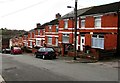
West side of Davies Street, Ystrad Mynach
Brick houses alongside the descent to Pengam Road.
Image: © Jaggery
Taken: 10 Dec 2018
0.05 miles
5
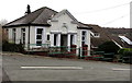
Hengoed Gospel Hall, Davies Street, Ystrad Mynach
The building dates from 1900. https://www.geograph.org.uk/photo/5997292 to the information board on display in December 2018.
Image: © Jaggery
Taken: 10 Dec 2018
0.07 miles
6
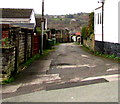
Side road on the west side of Davies Street, Ystrad Mynach
Viewed across Davies Street from the corner of The Avenue.
Image: © Jaggery
Taken: 10 Dec 2018
0.07 miles
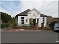
8
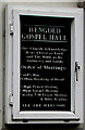
Information board for Hengoed Gospel Hall
On the wall here https://www.geograph.org.uk/photo/5997288 viewed in December 2018.
Image: © Jaggery
Taken: 10 Dec 2018
0.08 miles
9
Ordnance Survey Rivet
This OS rivet can be found on the east parapet of the railway bridge. It marks a point 134.895m above mean sea level.
Image: © Adrian Dust
Taken: 8 Jun 2019
0.08 miles
10
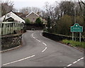
Southern boundary sign, Hengoed
Alongside Bedwlwyn Road viewed from the northern edge of Ystrad Mynach.
The road bridge and parallel footbridge span a railway.
The Dilwyn Avenue junction is in the background on the left.
Image: © Jaggery
Taken: 10 Dec 2018
0.08 miles