
IMAGES TAKEN NEAR TO
Main Road, HENGOED, CF82 7RN
Introduction
This page details the photographs taken nearby to Main Road, CF82 7RN by members of the Geograph project.
The Geograph project started in 2005 with the aim of publishing, organising and preserving representative images for every square kilometre of Great Britain, Ireland and the Isle of Man.

There are currently over 7.5m images from over14,400 individuals and you can help contribute to the project by visiting https://www.geograph.org.uk
Image Map
Images are licensed for reuse under creativecommons.org/licenses/by-sa/2.0
Notes
- Clicking on the map will re-center to the selected point.
- The higher the marker number, the further away the image location is from the centre of the postcode.
Image Listing (25 Images Found)
Images are licensed for reuse under creativecommons.org/licenses/by-sa/2.0
Image
Details
Distance
1
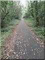
Footpath and cycle-track beside the A472, Maesycwmmer
Image: © John Lord
Taken: 24 Aug 2017
0.02 miles
2
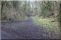
Track off Cycle Route 47, Maesycwmmer
This track through young woodland follows the course of a branch of a dismantled railway.
Image: © M J Roscoe
Taken: 24 Mar 2018
0.03 miles
3
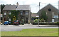
Main Road buildings, Maesycymmer
Located on the south side of the A472, near the corner of Gellideg Lane.
The derelict, bricked-up building on the right was formerly a church or chapel.
There is a small burial ground at the front.
Image: © Jaggery
Taken: 24 May 2011
0.05 miles
4
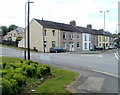
Row of houses, Main Road, Maesycwmmer
The 45-metre long row of houses is on the corner of Gellideg Lane.
Image: © Jaggery
Taken: 24 May 2011
0.05 miles
5
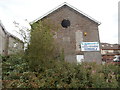
The former Zoar Chapel (Calvinistic Methodist), Maesycwmmer
Image: © John Lord
Taken: 24 Aug 2017
0.06 miles
6
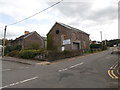
The former Zoar Chapel (Calvinistic Methodist), Maesycwmmer
Image: © John Lord
Taken: 24 Aug 2017
0.07 miles
7
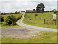
Entrance road to Ty-Howell Fechan Farm, Maesycwmmer
Viewed from the A472.
Image: © Jaggery
Taken: 24 May 2011
0.09 miles
8
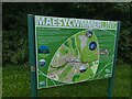
Village map on west of Maesycwmmer
Map of the village highlighting the shared path on the disused railway viaduct
Image: © David Smith
Taken: 27 Sep 2021
0.09 miles
9
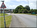
A472 reaches Maesycwmmer
The A472, from Pontllanfraith, approaches the eastern edge of Maesycwmmer, a village to the east of Ystrad Mynach.
Image: © Jaggery
Taken: 24 May 2011
0.09 miles
10
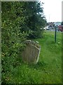
Village sign for Maesycwmmer
The sign represents the disused railway viaduct across the valley
Image: © David Smith
Taken: 27 Sep 2021
0.09 miles