1
Hope Church, Gelligaer Road, Cefn Hengoed
In August 2019 the nameboard shows Hope Church @ Bethel & Calvary. https://www.geograph.org.uk/photo/6245837
The building dates from 1933.
Image: © Jaggery
Taken: 22 Aug 2019
0.06 miles
2
Information for Bethel Chapel and Calvary Chapel on a Cefn Hengoed wall
On display in August 2019 on the left side of the church door here. https://www.geograph.org.uk/photo/6245834
Image: © Jaggery
Taken: 22 Aug 2019
0.06 miles
3
Hope Church name sign and Bethel Baptist Church date stone, Cefn Hengoed
Located here. https://www.geograph.org.uk/photo/6245834
Image: © Jaggery
Taken: 22 Aug 2019
0.06 miles
4
Junction of Hengoed Crescent and Gelligaer Road, Cefn Hengoed
Hope Church https://www.geograph.org.uk/photo/6245834 in Gelligaer Road is on the right.
Image: © Jaggery
Taken: 22 Aug 2019
0.06 miles
5
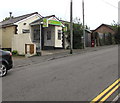
Cefn Hengoed: the post office
This rather primitive looking building will not be the post office for much longer: it will close on 7 March and the post office will move to a nearby convenience store. Across the gable, one can see the remains of timber signage with the name CEFN HENGOED visible - presumably POST OFFICE was once written on the opposite side.
See
Image] for a closer look at the postbox.
Image: © Chris Downer
Taken: 1 Mar 2014
0.07 miles
6
Cefn Hengoed: postbox № CF82 284, Gelligaer Road
This George VI-reign postbox is set into a stone pillar outside
Image and will probably be moved or replaced when the post office relocates in March 2014.
Image: © Chris Downer
Taken: 1 Mar 2014
0.07 miles
7
Peppino's Pizza in Cefn Hengoed
Takeaway at 181 Gelligaer Road.
Image: © Jaggery
Taken: 22 Aug 2019
0.07 miles
8
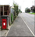
King George VI postbox in a Gelligaer Road wall, Cefn Hengoed
Outside a former post office, the box is on the right here https://www.geograph.org.uk/photo/6244416 viewed in August 2019.
Chris Downer's March 2014 photo https://www.geograph.org.uk/photo/3870308 shows the post office when open.
Image: © Jaggery
Taken: 22 Aug 2019
0.07 miles
9
Gelligaer Road speed bumps, Cefn Hengoed
Bumps/humps on the ascent towards Hengoed.
Image: © Jaggery
Taken: 22 Aug 2019
0.07 miles
10
West along Lansbury Avenue, Cefn Hengoed
From Gelligaer Road. The Cross Keys Inn https://www.geograph.org.uk/photo/6244717 is behind the camera.
Image: © Jaggery
Taken: 22 Aug 2019
0.07 miles


