1
Cae Ffynnon, Penybryn
Cul-de-sac on the east side of Penallta Road in Penybryn near Gelligaer.
Image: © Jaggery
Taken: 13 Feb 2019
0.01 miles
2
Welsh-only name sign, Cae Ffynnon, Penybryn
The cul-de-sac Cae Ffynnon https://www.geograph.org.uk/photo/6058866 does not have an English version of its name.
Image: © Jaggery
Taken: 13 Feb 2019
0.02 miles
3
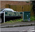
Greenhill Close, Penybryn
Cul-de-sac on the east side of Trosnant Close in Penybryn near Gelligaer.
Image: © Jaggery
Taken: 13 Feb 2019
0.03 miles
4
Houses on a Penybryn corner
On the corner of Penallta Road and Gelliwen Street viewed in February 2019.
The dark green telecoms cabinet is not in an October 2015 Google Street View of this corner.
Image: © Jaggery
Taken: 13 Feb 2019
0.04 miles
5
Bilingual street name sign in Penybryn
The sign on the right here https://www.geograph.org.uk/photo/6058753 shows that Greenhill Close is Clos y Bryn Gwyrdd in Welsh.
Image: © Jaggery
Taken: 13 Feb 2019
0.05 miles
6
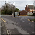
Triangle at a junction in Penybryn
Viewed along Trosnant Crescent looking towards the Penallta Road junction.
Image: © Jaggery
Taken: 13 Feb 2019
0.05 miles
7
Into Penybryn from Gelligaer
Looking to the south along Penallta Road past the Penybryn boundary sign https://www.geograph.org.uk/photo/6389589
Image: © Jaggery
Taken: 13 Feb 2019
0.05 miles
8
Locked grey gates, Penallta Road, Penybryn
The gates give authorised staff access to a Wales & West Utilities gas installation.
Image: © Jaggery
Taken: 13 Feb 2019
0.05 miles
9
Northern boundary of Penybryn
Penallta Road from Gelligaer passes the boundary sign for Penybryn, a small village in Caerphilly County Borough.
Image: © Jaggery
Taken: 10 May 2013
0.05 miles
10
Boarded-up house behind a tree, Penybryn
Opposite Gelliwen Street viewed in February 2019.
Image: © Jaggery
Taken: 13 Feb 2019
0.05 miles


