1
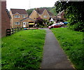
Path to Camnant, Ystrad Mynach
Along the path from Twyn Road towards Camnant, a street at the northern edge of the Forge Mill development.
Image: © Jaggery
Taken: 3 Jun 2019
0.08 miles
2
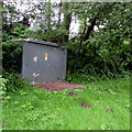
Twyn Road electricity substation, Ystrad Mynach
The grey cabinet is a Western Power Distribution electricity substation.
Its identifier is TWYN RD YSTRAD MYNACH S/S 552611
Image: © Jaggery
Taken: 3 Jun 2019
0.08 miles
3
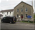
Twyn Road houses west of Bethania Chapel, Ystrad Mynach
The van is parked outside Bethania Chapel. https://www.geograph.org.uk/photo/6171479
Image: © Jaggery
Taken: 3 Jun 2019
0.10 miles
4
Bethania, formerly Welsh Calvinistic Methodist chapel, now Seventh Day Adventist church, Twyn Rd, Ystrad Mynach
Image: © John Lord
Taken: 26 Aug 2017
0.10 miles
5
Welsh inscription on Bethania Chapel, Twyn Road, Ystrad Mynach
The Welsh tablet on the wall here https://www.geograph.org.uk/photo/6171479 shows 1866, the year in which
the original Calvinistic Methodist chapel (capel in Welsh) of 1810 was rebuilt.
Image: © Jaggery
Taken: 3 Jun 2019
0.10 miles
6
Information board, Bethania Chapel, Twyn Road, Ystrad Mynach
The board on the right here https://www.geograph.org.uk/photo/6171479 shows that Bethania Chapel is a Seventh-Day Adventist Church in 2019.
Image: © Jaggery
Taken: 3 Jun 2019
0.10 miles
7
Bethania Chapel, Twyn Road, Ystrad Mynach
In June 2019 the board https://www.geograph.org.uk/photo/6171486 shows that Bethania Chapel is a Seventh-Day Adventist Church.
The building is the 1866 rebuild of the original Calvinistic Methodist chapel of 1810.
Image: © Jaggery
Taken: 3 Jun 2019
0.10 miles
8
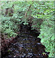
Upstream along Nant Twynyrharris, Ystrad Mynach
Viewed from this https://www.geograph.org.uk/photo/6171659 footbridge on June 3rd 2019.
The brook Nant Twynyrharris is a small tributary of the Rhymney River.
Image: © Jaggery
Taken: 3 Jun 2019
0.10 miles
9
Footbridge over a brook, Ystrad Mynach
From the south side of Twyn Road, the footbridge carries a path
to Camnant https://www.geograph.org.uk/photo/6171652 over the brook named Nant Twynyrharris.
Image: © Jaggery
Taken: 3 Jun 2019
0.10 miles
10
Nant Twynyrharris by Twyn Road, Ystrad Mynach
Stream between Twyn Road and housing estate, right; viewed from footbridge.
Image: © M J Roscoe
Taken: 18 Jan 2018
0.10 miles


