1
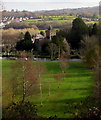
Holy Trinity church, Ystrad Mynach
Viewed across Nelson Road (A472). The full title of the church is
Holy Trinity Church, Ystrad Mynach, in the Parish of Ystrad Mynach and Llanbradach in the Rural Deanery of Caerphilly in the Diocese of Llandaff in the Church in Wales.
The church is located on the corner of Nelson Road and Cedar Way. Construction of the church began in August 1855 with the laying of a foundation stone. The church was significantly enlarged in 1906. It has remained essentially in the form seen here since then.
Image: © Jaggery
Taken: 27 Aug 2010
0.07 miles
2
Graveyard, Holy Trinity Church, Ystrad Mynach
Part of the graveyard viewed from a footpath.
Image: © M J Roscoe
Taken: 28 Dec 2017
0.10 miles
3
Path between graveyard and school grounds
The graveyard of Holy Trinity Church is on the left.
Image: © M J Roscoe
Taken: 28 Dec 2017
0.11 miles
4
The middle of Ystrad Mynach railway station
The absence of a wide enough area of flat land meant that the station platforms are staggered. This view, from near the southern end of the northbound platform, shows the southbound platform beyond the connecting footbridge.
Image: © Jaggery
Taken: 27 Aug 2010
0.12 miles
5
Twin tracks towards Holy Trinity Church, Ystrad Mynach
Viewed from Ystrad Mynach railway station footbridge, http://www.geograph.org.uk/photo/4807763 about 250 metres from the church.
Holy Trinity Church is part of the Parish of Ystrad Mynach and Llanbradach
in the Church in Wales Diocese of Llandaff. http://www.geograph.org.uk/photo/2065780 to a closer view and some details.
Image: © Jaggery
Taken: 28 Jan 2016
0.12 miles
6
Holy Trinity, Ystrad Mynach
The church in the Church in Wales Diocese of Llandaff was erected in 1855-1857. Grade II listed in 2001 for its architectural interest as an unusually planned and carefully detailed Gothic church designed by architect John Norton.
Image: © Jaggery
Taken: 26 Nov 2018
0.12 miles
7
Passing trains at Ystrad Mynach
Class 66 No. 66183 waits with for a path out onto the main line at Ystrad Mynach with its loaded coal working from Cwmbargoed while a Transport for Wales class 231 unit arrives from the south.
Image: © Gareth James
Taken: 9 Oct 2023
0.12 miles
8
Holy Trinity Church
Parish Church in Ystrad Mynach.
Image: © Alan Hughes
Taken: 30 Mar 2021
0.12 miles
9
Ordnance Survey Cut Mark
This OS cut mark can be found on the NE face of Holy Trinity Church. It marks a point 110.807m above mean sea level.
Image: © Adrian Dust
Taken: 8 Jun 2019
0.12 miles
10
Class 231 unit at Ystrad Mynach
A Transport for Wales class 231 unit approaches Ystrad Mynach station with a service for Bargoed.
Image: © Gareth James
Taken: 9 Oct 2023
0.12 miles


