1
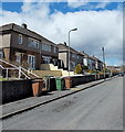
Dan-y-graig houses, Pontlottyn
Viewed from the connecting road from Heol-y-waun. Some sources shown Danygraig or Dan y Graig.
Each of the three buildings contains four houses.
Image: © Jaggery
Taken: 19 Apr 2013
0.03 miles
2
Dan-y-Graig, Pontlottyn
Bungalows below the A469 here named Southend Terrace.
Image: © Jaggery
Taken: 27 Jul 2018
0.04 miles
3
Southend Terrace, Pontlottyn [2]
The A469 on the southern outskirts of Pontlottyn.
Image: © Robin Drayton
Taken: 23 Aug 2008
0.04 miles
4
Long row of lock-up garages, Pontlottyn
The 35 metre long row of garages is between the residential street Heol-y-waun
and the Rhymney Line railway on the west bank of the Rhymney River.
Image: © Jaggery
Taken: 19 Apr 2013
0.05 miles
5
Houses at the SE end of Heol-y-waun, Pontlottyn
There are no houses on the opposite side of Heol-y-waun here. These houses have views across
the Rhymney Line railway, the banks of the Rhymney River, and the higher ground beyond.
Image: © Jaggery
Taken: 19 Apr 2013
0.06 miles
6
Houses at the southern end of Pontlottyn
The Rhymney River runs along the line of trees in the foreground.
This was the border between the old counties of Monmouthshire and Glamorganshire.
Now, at this point, both sides are in the Caerphilly County Borough.
Image: © Robin Drayton
Taken: 14 May 2014
0.06 miles
7
Southend Garage, Pontlottyn
Viewed across the A469 here named Southend Terrace.
Image: © Jaggery
Taken: 27 Jul 2018
0.07 miles
8
A Pontlottyn garage
Viewed across the A469 Southend Terrace, opposite Mozart Cottages. http://www.geograph.org.uk/photo/3423871
There are four named bays: MoT bay, service bay, valeting bay, tyre bay.
Image: © Jaggery
Taken: 19 Apr 2013
0.07 miles
9
Mozart Cottages, Pontlottyn
Viewed from the A469 Southend Terrace. I could find no explanation for the unusual name of the three cottages. Perhaps they were built by or for an admirer of Wolfgang Amadeus Mozart.
Image: © Jaggery
Taken: 19 Apr 2013
0.08 miles
10
Hillside houses, Pontlottyn
Viewed across the Rhymney Valley from Abertysswg.
In the foreground is an Arriva Trains Wales service from Rhymney to Cardiff.
Behind this, terraced houses, built over 100 years ago, climb steeply up the hillside to the A469. Along the A469 there is a variety of housing styles. Beyond is a mid 20th century housing estate.
Image: © Robin Drayton
Taken: 8 Oct 2008
0.09 miles


![Southend Terrace, Pontlottyn [2]](https://s3.geograph.org.uk/geophotos/01/16/10/1161099_6d0f47ce_120x120.jpg)


