1
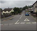
Picton Terrace, Pontlottyn
Row of stone houses at the northern end of Farm Road.
Image: © Jaggery
Taken: 27 Jul 2018
0.02 miles
2
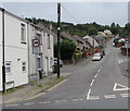
Yellow grit bin on a Pontlottyn corner
On the Farm Road side of the Heol Evan Wynne corner.
Image: © Jaggery
Taken: 27 Jul 2018
0.04 miles
3
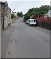
Farm Road, Pontlottyn
South along Farm Road from the Hill Road/Heol Evan Wynne/Legion Court crossroads.
Image: © Jaggery
Taken: 27 Jul 2018
0.04 miles
4
Heol Evan Wynne, Pontlottyn
Heol Evan Wynne climbs away from Merchant Street past the right turn for houses in North Rising.
In the distance, the road is fittingly renamed Hill Road as the gradient increases to 20% (1 in 5).
Image: © Jaggery
Taken: 19 Apr 2013
0.04 miles
5
Heol Evan Wynne semis, Pontlottyn
Semi-detached houses on the south side of Heol Evan Wynne. The North Rising https://www.geograph.org.uk/photo/5856233 junction is on the right.
Image: © Jaggery
Taken: 27 Jul 2018
0.05 miles
6
Lord Nelson, Heol Evan Wynne, Pontlottyn
Hotel and pub viewed from the corner of Hill Road and Farm Road.
Image: © Jaggery
Taken: 27 Jul 2018
0.05 miles
7
West along Heol Evan Wynne, Pontlottyn
From the A469, Heol Evan Wynne ascends towards Hill Road and a steep route to Fochriw.
Image: © Jaggery
Taken: 27 Jul 2018
0.06 miles
8
Hill Road, Pontlottyn
Looking westwards away from Pontlottyn. Hill Road is steeper out of shot ahead, where
Ordnance Survey maps show two chevrons indicating a gradient of 20% (1 in 5) or steeper.
Image: © Jaggery
Taken: 27 Jul 2018
0.06 miles
9
View over Pontlottyn
Image: © Alan Hughes
Taken: 11 Jul 2023
0.07 miles
10
Lord Nelson pub, Pontlottyn
Sporting some vintage signage - an old Whitbread swing sign and some 1970's retro name lettering. I felt if I went in maybe I would find beer was still 50p a pint. So I didn't dare
Image: © Jeremy Bolwell
Taken: 16 Sep 2012
0.08 miles


