1
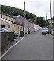
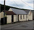
Jenkins Row leading to Ysgwyddgwyn, Deri
Viewed from the corner of Bailey Street. The houses in the background are in the part of Deri named Ysgwyddgwyn. Ysgwyddgwyn is the original name of the village of Deri. The village name was changed in the 19th century because many incomers to the village (for work in the colliery) could not pronounce Ysgwyddgwyn.
Image: © Jaggery
Taken: 12 Jul 2018
0.01 miles
2
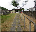
Steep ascent from the west side of Bailey Street, Deri
Image: © Jaggery
Taken: 12 Jul 2018
0.02 miles
3
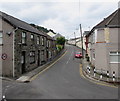
SE along Bailey Street, Deri
This way for Bargoed.
Image: © Jaggery
Taken: 12 Jul 2018
0.04 miles
4
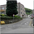
Bailey Street, Deri
Ahead for Pentwyn and Fochriw.
Image: © Jaggery
Taken: 12 Jul 2018
0.04 miles
5
Bailey Street houses near the Bailey's Arms , Deri
The edge of the Bailey's Arms https://www.geograph.org.uk/photo/5843509 is on the right.
Image: © Jaggery
Taken: 12 Jul 2018
0.04 miles
6
Deri Broncos Rugby Football Club club house, Deri
Viewed across Mill Road in July 2018. A notice near the entrance
shows that the Broncos were WRU National League 3 East Champions
in the 2017-2018 season. WRU = Welsh Rugby Union.
The building was originally Deri Workmen's Hall & Institute
which opened in March 1924.
Image: © Jaggery
Taken: 12 Jul 2018
0.05 miles
7
Up Mill Road, Deri
Mill Road ascends past Deri Broncos Rugby Football Club club house. https://www.geograph.org.uk/photo/5840339
Image: © Jaggery
Taken: 12 Jul 2018
0.05 miles
8
Steep ascent, Mill Road, Deri
Deri Broncos Rugby Football Club clubhouse https://www.geograph.org.uk/photo/5840339 is on the left.
Image: © Jaggery
Taken: 12 Jul 2018
0.05 miles
9
The Bailey's Arms in Deri
Pub alongside Bailey Street.
Image: © Jaggery
Taken: 12 Jul 2018
0.05 miles
10
Bailey's Arms, Bailey Street, Deri
Pub near the southern end of Bailey Street.
Image: © Jaggery
Taken: 12 Jul 2018
0.05 miles


