1
New Road houses and cars, Deri
Looking to the NNW along New Road towards the centre of the village.
Image: © Jaggery
Taken: 12 Jul 2018
0.01 miles
2
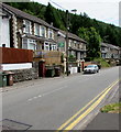
Long row of houses, New Road, Deri
Looking past steps ascending Hill Street. https://www.geograph.org.uk/photo/5839644
Image: © Jaggery
Taken: 12 Jul 2018
0.03 miles
3
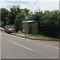
New Road bus stop and shelter near Hill Street, Deri
This stop is for buses to Bargoed.
Image: © Jaggery
Taken: 12 Jul 2018
0.04 miles
4
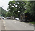
UPS delivery van parked in New Road, Deri
UPS (United Parcel Service, Inc.) is the world's largest package delivery company.
Its headquarters are in Sandy Springs, Georgia, USA.
Image: © Jaggery
Taken: 12 Jul 2018
0.04 miles
5
Stop in New Road Deri for buses to Merthyr Tydfil
In July 2018 the stop is on Stagecoach Route 1 from Bargoed to Merthyr Tydfil via Fochriw, Pontlottyn, Rhymney.
Image: © Jaggery
Taken: 12 Jul 2018
0.05 miles
6
Hill Street, Deri
Ascending from New Road.
Image: © Jaggery
Taken: 12 Jul 2018
0.09 miles
7
New Road houses, Deri
Viewed from this https://www.geograph.org.uk/photo/5860930 bus stop looking towards the southeast edge of the village.
Image: © Jaggery
Taken: 12 Jul 2018
0.10 miles
8
Start of the 30 zone, New Road, Deri
At the SE edge of the village, the National Speed Limit drops to 30mph. ARAF is Welsh for SLOW.
Image: © Jaggery
Taken: 12 Jul 2018
0.10 miles
9
New Road, Deri
Southern approach to the former mining village. The road, near right, is the access road to Deri Forest
Image
Image: © M J Roscoe
Taken: 28 Mar 2018
0.10 miles
10
Southern boundary of Deri
The road from Bargoed reaches the village of Deri in Caerphilly County Borough. Deri is Welsh for oaks. Deri was formerly known as Ysgwyddgwyn. The village was renamed Deri in the 19th century after many incomers to the area, who had come to work in the colliery, could not pronounce Ysgwyddgwyn.
Image: © Jaggery
Taken: 12 Jul 2018
0.11 miles


