IMAGES TAKEN NEAR TO
BARGOED, CF81 9GF
Introduction
This page details the photographs taken nearby to CF81 9GF by members of the Geograph project.
The Geograph project started in 2005 with the aim of publishing, organising and preserving representative images for every square kilometre of Great Britain, Ireland and the Isle of Man.

There are currently over 7.5m images from over14,400 individuals and you can help contribute to the project by visiting https://www.geograph.org.uk
Image Map
Images are licensed for reuse under creativecommons.org/licenses/by-sa/2.0
Notes
- Clicking on the map will re-center to the selected point.
- The higher the marker number, the further away the image location is from the centre of the postcode.
Image Listing (14 Images Found)
Images are licensed for reuse under creativecommons.org/licenses/by-sa/2.0
Image
Details
Distance
1
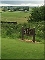
View from Bargoed Golf Course
View from the 4th tee at Bargoed Golf Course towards Pencaedrain.
Image: © Alan Hughes
Taken: 17 Jun 2016
0.01 miles
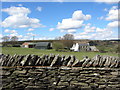
3
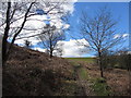
Pencaedrain
I know the last four letters of this farm's name do not mean "rain" but is seemed appropriate as the rain had returned in earnest after a glorious sunny walk through SO1300 to the north. The farm is on the northern edge of the square, enclosed yet close to the open land of Gelligaer Common.
Image: © Graham Horn
Taken: 1 Dec 2007
0.03 miles
4
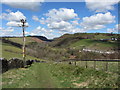
Footpath near Pencaedrain
Looking north, with views into the Nant Bargod Rhymni valley.
Image: © Gareth James
Taken: 17 Apr 2016
0.08 miles
6
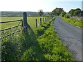
Minor road near Bargoed
This road passes through the upland farmland between Bargoed and Deri.
Image: © Robin Drayton
Taken: 5 Jun 2013
0.21 miles
7
Lane to Pencaedrain
Lane, that is also part of the Rhymney Valley Ridgeway FP, heading towards Pencaedrain from Heolddu Uchaf.
Image: © M J Roscoe
Taken: 8 Apr 2017
0.21 miles
8
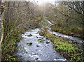
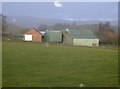
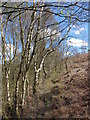
Nant Bargod Rhymni
The stream flowing down the Darren valley has just been joined by a substantial side stream and is now quite a large river. Soon it will itself join the Rhymney River.
Image: © Graham Horn
Taken: 1 Dec 2007
0.22 miles
10
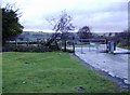
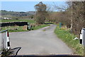
Cattle grid on road north off the common
Beyond the cattle grid the lane straight on leads to Pencaedrain, the one to the left leads to Pen-y-garreg. To see the other cattle grid on the road from Bargoed turn to your right.
Image: © Graham Horn
Taken: 1 Dec 2007
0.22 miles