1
Cwrt Neuadd Wen, Aberbargoed
Cwrt Neuadd Wen is a cul-de-sac of modern houses on the south side of Bedwellty Road.
Image: © Jaggery
Taken: 1 Jun 2013
0.02 miles
2
Bedwellty Road approaches Aberbargoed
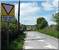
The road west from the hamlet of Bedwellty reaches the start of the 30mph zone in Aberbargoed.
The B4511 is 50 yards ahead.
Image: © Jaggery
Taken: 1 Jun 2013
0.03 miles
3
Road from Aberbargoed to Bedwellty
Viewed across the B4511. The sign on the left shows ½ mile to Bedwellty.
Image: © Jaggery
Taken: 1 Jun 2013
0.03 miles
4
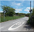
End of the 30mph zone at the edge of Aberbargoed
A few metres beyond the turning for Cwrt Neuadd Wen, http://www.geograph.org.uk/photo/3498315 the 30mph speed limit in Aberbargoed increases to the National Speed Limit on the road to Bedwellty.
Image: © Jaggery
Taken: 1 Jun 2013
0.05 miles
5
Neuadd Wen Aberbargoed
The Bedwellty Road pub is in the NE of the village.
Image: © Jaggery
Taken: 1 Jun 2013
0.07 miles
6
Church View, the self build village, Bedwellty
Viewed from Bedwellty Road. A notice near this fenced-off development site states that this is "a unique opportunity to design and build your home on one of a selection of fully-serviced individual building plots". An addition to the board shows "20% off selected plots. Part exchange now available".
Image: © Jaggery
Taken: 1 Jun 2013
0.10 miles
7
Coedymoeth Road, Aberbargoed
Houses in the NE of the village viewed across Bedwellty Road.
Image: © Jaggery
Taken: 1 Jun 2013
0.10 miles
8
Rusty corrugated building, Aberbargoed
Viewed across Bedwellty Road. I wonder what it was used for.
Image: © Jaggery
Taken: 1 Jun 2013
0.11 miles
9
Youth and Community Centre, Aberbargoed
Located in The Hangar, set back 130 metres from Bedwellty Road.
The Hangar was opened in July 2009. The building previously housed a skate park,
which had closed in 2008 following a decline in usage.
Image: © Jaggery
Taken: 1 Jun 2013
0.13 miles
10
Thomas Street Aberbargoed
Viewed across Bedwellty Road.
Image: © Jaggery
Taken: 1 Jun 2013
0.15 miles


