
IMAGES TAKEN NEAR TO
Chapel Street, BARGOED, CF81 9BZ
Introduction
This page details the photographs taken nearby to Chapel Street, CF81 9BZ by members of the Geograph project.
The Geograph project started in 2005 with the aim of publishing, organising and preserving representative images for every square kilometre of Great Britain, Ireland and the Isle of Man.

There are currently over 7.5m images from over14,400 individuals and you can help contribute to the project by visiting https://www.geograph.org.uk
Image Map
Images are licensed for reuse under creativecommons.org/licenses/by-sa/2.0
Notes
- Clicking on the map will re-center to the selected point.
- The higher the marker number, the further away the image location is from the centre of the postcode.
Image Listing (334 Images Found)
Images are licensed for reuse under creativecommons.org/licenses/by-sa/2.0
Image
Details
Distance
1
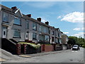
Chapel Street houses, Aberbargoed
Viewed from the edge of a former chapel http://www.geograph.org.uk/photo/3495447 looking towards the corner of Mount Pleasant Street.
The houses in Chapel Street are all on the east side of the street.
The land beyond the west side slopes steeply towards the Rhymney valley.
Image: © Jaggery
Taken: 1 Jun 2013
0.02 miles
2
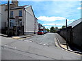
Chapel Street, Aberbargoed
Chapel Street heads south away from Bedwellty Road. Walking along this level street gave my weary legs time to recover from the very steep http://www.geograph.org.uk/photo/3495416 climb partway up Bedwellty Road.
Image: © Jaggery
Taken: 1 Jun 2013
0.02 miles
3
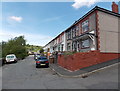
Chapel Street, Aberbargoed
Viewed from the School Street end.
Image: © Jaggery
Taken: 1 Jun 2013
0.02 miles
4
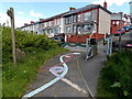
Footprints on the path, Aberbargoed
There are representations of human footprints, animal paw prints and bird footprints
next to the barriers at the Chapel Street end of a footpath.
Image: © Jaggery
Taken: 1 Jun 2013
0.04 miles
5
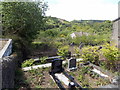
Chapel Street graveyard, Aberbargoed
On the south side of the former Caersalem Baptist Chapel. http://www.geograph.org.uk/photo/3495447
Image: © Jaggery
Taken: 1 Jun 2013
0.05 miles
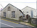
7
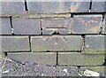
Ordnance Survey Cut Mark
This OS cut mark can be found on the wall of No16 Bedwellty Road. It marks a point 202.683m above mean sea level.
Image: © Adrian Dust
Taken: 12 Feb 2021
0.05 miles
8

Caersalem Baptist Chapel, Aberbargoed
Part of the facade of an old baptist chapel that is situated on Bedwellty Road and is no longer in use.
Image: © Robin Drayton
Taken: 13 Mar 2013
0.05 miles
9
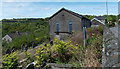
Former Caersalem Baptist Chapel, Aberbargoed
Located below road level on the corner of Chapel Street and Bedwellty Road.
The derelict chapel is an 1860 rebuild of the 1839 original.
Image: © Jaggery
Taken: 1 Jun 2013
0.05 miles
10
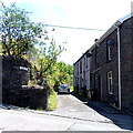
Glen View, Aberbargoed
A 30 metre long cul-de-sac viewed from Bedwellty Road.
Image: © Jaggery
Taken: 1 Jun 2013
0.06 miles