1
Aberbargoed Village Hall
Viewed across Commercial Street Aberbargoed.
Image: © Jaggery
Taken: 4 Jul 2013
0.02 miles
2
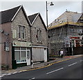
Former Police Station, Aberbargoed
Dated 1909, it is now a residential property.
Image: © Robin Drayton
Taken: 12 Nov 2008
0.03 miles
3
Scaffolding on Blaen-y-Cwm Aberbargoed
Blaen-y-Cwm, on the corner of Commercial Street and Bedwellty Road, contains 30 flats.
Image: © Jaggery
Taken: 4 Jul 2013
0.04 miles
4
328 Aberbargoed
328 is a takeaway (Chinese and English cuisine) at 4 Commercial Street, on the corner of Mount Pleasant Street. The premises formerly housed the Golden Star takeaway.
Image: © Jaggery
Taken: 4 Jul 2013
0.04 miles
5
328 takeaway at 4 Commercial Street, Aberbargoed
In June 2019, the nameboard of 328 takeaway on the corner of Mount Pleasant Street shows
Chinese & English meals to take away - Delivery Service Available.
Image: © Jaggery
Taken: 5 Jun 2019
0.04 miles
6
Bedwellty Road climbs away from Chapel Street, Aberbargoed
Bedwellty Road ascends eastwards towards Commercial Street.
Image: © Jaggery
Taken: 1 Jun 2013
0.04 miles
7
20 Zone signs, Mount Pleasant Street, Aberbargoed
On the approach to a school, the 30mph speed on the A4049 Commercial Street
drops to 20mph along Mount Pleasant Street. PARTH is Welsh for ZONE.
Image: © Jaggery
Taken: 5 Jun 2019
0.04 miles
8
Commercial Street, Aberbargoed
This is the A4049 looking northwards approaching the junction with Bedwellty Road.
Image: © Robin Drayton
Taken: 12 Nov 2008
0.04 miles
9
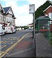
Commercial Street bus stop and shelter, Aberbargoed
Opposite Blaen-y-cwm flats. https://www.geograph.org.uk/photo/6173594 In June 2019 the sign shows that
this is a stop on bus routes 2 and 27 to Bargoed and route 12 to Blackwood.
Image: © Jaggery
Taken: 5 Jun 2019
0.04 miles
10
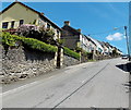
Houses on the north side of Bedwellty Road, Aberbargoed
Bedwellty Road ascends from the valley of the River Rhymney towards the centre of
Aberbargoed. A sign http://www.geograph.org.uk/photo/3495159 at the foot of the hill shows a 20% (1 in 5) gradient.
Image: © Jaggery
Taken: 1 Jun 2013
0.04 miles


