IMAGES TAKEN NEAR TO
Bedwellty Road, BARGOED, CF81 9AY

Introduction

This page details the photographs taken nearby to Bedwellty Road, CF81 9AY by members of the Geograph project.

The Geograph project started in 2005 with the aim of publishing, organising and preserving representative images for every square kilometre of Great Britain, Ireland and the Isle of Man.

There are currently over 7.5m images from over14,400 individuals and you can help contribute to the project by visiting https://www.geograph.org.uk

Image Map


Images are licensed for reuse under creativecommons.org/licenses/by-sa/2.0
Notes
  • Clicking on the map will re-center to the selected point.
  • The higher the marker number, the further away the image location is from the centre of the postcode.

Image Listing (118 Images Found)

Images are licensed for reuse under creativecommons.org/licenses/by-sa/2.0
  • ...
Image
Details
Distance
1
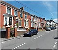
Bedwellty Road houses east of Neuaddwen Street Aberbargoed
The Neuaddwen Street turning is on the right.
Image: © Jaggery Taken: 1 Jun 2013
0.04 miles
2
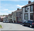
Bedwellty Road east of Pant Street Aberbargoed
The houses are on the north side of Bedwellty Road, viewed from the corner of Pant Street.
Image: © Jaggery Taken: 1 Jun 2013
0.06 miles
3
Aberbargoed Buds AFC
This is the NE corner of The Recreation Ground, home of Aberbargoed Buds AFC (Association Football Club) viewed from the edge of the B4511 Bedwellty Road. The club was founded in the 1950s after the demise of Aberbargoed Town who played in the Welsh League before folding c1949. One plausible explanation for the unusual name Buds is an acronym for Bedwellty Urban District Sides.
Image: © Jaggery Taken: 1 Jun 2013
0.07 miles
4
Rhiwamoth Street Aberbargoed
Viewed from the Bedwellty Road end looking SSE towards Yew Street. There are houses on only one side of Rhiwamoth Street. On the opposite side is a large recreation ground.
Image: © Jaggery Taken: 1 Jun 2013
0.08 miles
5
Sannan Street Aberbargoed
Viewed across Bedwellty Road.
Image: © Jaggery Taken: 1 Jun 2013
0.08 miles
6
Steps from Pant Street to Neuaddwen Street Aberbargoed
The steps lead from the corner of the clinic http://www.geograph.org.uk/photo/3496442 to a path at the rear of houses in Neuaddwen Street.
Image: © Jaggery Taken: 1 Jun 2013
0.09 miles
7
Neuaddwen Street Aberbargoed
Viewed from the Bedwellty Road end looking towards Yew Street.
Image: © Jaggery Taken: 1 Jun 2013
0.10 miles
8
Aberbargoed Library
Part of Caerphilly County Borough Council's library service, the library in Pant Street reopened in May 2013 after a £90,000 refurbishment and modernisation. Aberbargoed Clinic http://www.geograph.org.uk/photo/3496442 is on the right.
Image: © Jaggery Taken: 1 Jun 2013
0.10 miles
9
Aberbargoed Clinic
Located in Pant Street.
Image: © Jaggery Taken: 1 Jun 2013
0.10 miles
10
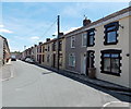
Bedwellty Road Aberbargoed
The B4511 Bedwellty Road descends towards Commercial Street Aberbargoed.
Image: © Jaggery Taken: 1 Jun 2013
0.10 miles
  • ...