1
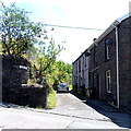
Glen View, Aberbargoed
A 30 metre long cul-de-sac viewed from Bedwellty Road.
Image: © Jaggery
Taken: 1 Jun 2013
0.01 miles
2
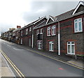
Very steep ascent ahead from Bargoed to Aberbargoed
A view along Bedwellty Road from the bridge over the River Rhymney.
The sign shows a 20% (1 in 5) gradient http://www.geograph.org.uk/photo/3495212 ahead, unsuitable for heavy goods vehicles.
Image: © Jaggery
Taken: 1 Jun 2013
0.01 miles
3
Chapel Street graveyard, Aberbargoed
On the south side of the former Caersalem Baptist Chapel. http://www.geograph.org.uk/photo/3495447
Image: © Jaggery
Taken: 1 Jun 2013
0.02 miles
4
Hillside chapel in Aberbargoed
Image: © Gareth James
Taken: 1 Mar 2019
0.02 miles
5
Very steep ascent into Aberbargoed
Bedwellty Road from Bargoed climbs towards the centre of Aberbargoed.
A sign http://www.geograph.org.uk/photo/3495159 behind the camera shows a 20% (1 in 5) gradient ahead, unsuitable for heavy goods vehicles.
Image: © Jaggery
Taken: 1 Jun 2013
0.02 miles
6
Caersalem Baptist Chapel, Aberbargoed
Part of the facade of an old baptist chapel that is situated on Bedwellty Road and is no longer in use.
Image: © Robin Drayton
Taken: 13 Mar 2013
0.02 miles
7
Former Caersalem Baptist Chapel, Aberbargoed
Located below road level on the corner of Chapel Street and Bedwellty Road.
The derelict chapel is an 1860 rebuild of the 1839 original.
Image: © Jaggery
Taken: 1 Jun 2013
0.02 miles
8
Bedwellty Road west of crossroads, Aberbargoed
Bedwellty Road climbs away from this http://www.geograph.org.uk/photo/3541353 major junction.
Image: © Jaggery
Taken: 4 Jul 2013
0.03 miles
9
Bedwellty Road, Aberbargoed
An extremely steep road which leads down to the River Rhymney and then to Bargoed, part of which can be seen on the hill opposite.
Until very recently, this was the only road connecting Aberbargoed with Bargoed.
Image: © Robin Drayton
Taken: 12 Nov 2008
0.03 miles
10
Bedwellty Road, Aberbargoed
This is the road that crosses the Rhymney Valley and until recent years was the only connection between Bargoed and Aberbargoed.
For a view looking down this road see http://www.geograph.org.uk/photo/3370762
Image: © Robin Drayton
Taken: 13 Mar 2013
0.03 miles


