
IMAGES TAKEN NEAR TO
Bargoed Gateway, BARGOED, CF81 8RE
Introduction
This page details the photographs taken nearby to Bargoed Gateway, CF81 8RE by members of the Geograph project.
The Geograph project started in 2005 with the aim of publishing, organising and preserving representative images for every square kilometre of Great Britain, Ireland and the Isle of Man.

There are currently over 7.5m images from over14,400 individuals and you can help contribute to the project by visiting https://www.geograph.org.uk
Image Map
Images are licensed for reuse under creativecommons.org/licenses/by-sa/2.0
Notes
- Clicking on the map will re-center to the selected point.
- The higher the marker number, the further away the image location is from the centre of the postcode.
Image Listing (262 Images Found)
Images are licensed for reuse under creativecommons.org/licenses/by-sa/2.0
Image
Details
Distance
1
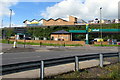
Morrisons on two levels, Bargoed
Morrisons Refuel filling station is alongside the A469 Station Road.
Morrisons superstore in the background is in Bargoed Gateway.
Image: © Jaggery
Taken: 5 Jun 2019
0.01 miles
2
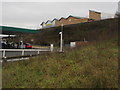
Morrisons Bargoed
Superstore in Bargoed Gateway viewed from Station Road.
Morrisons Refuel https://www.geograph.org.uk/photo/5997743 is near the camera.
Image: © Jaggery
Taken: 10 Dec 2018
0.01 miles
3
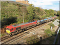
Rail-Head Treatment Train at Bargoed
A rail-head treatment train approaches Bargoed with class 66 locomotives No. 66185 and No. 66115 in charge.
Image: © Gareth James
Taken: 31 Oct 2018
0.03 miles
4
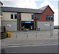
Greggs in Bargoed town centre
Viewed across Hanbury Road.
Image: © Jaggery
Taken: 25 Apr 2018
0.03 miles
5
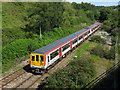
Class 769 near Bargoed
Newly re-built class 769 unit No. 769008 is seen on a test run heading south near Bargoed.
Image: © Gareth James
Taken: 7 Aug 2020
0.03 miles
6
Hanbury Road perimeter fence of The Plateau, Bargoed
The Plateau http://www.geograph.org.uk/photo/3464409 is a major retail development in Bargoed town centre.
Image: © Jaggery
Taken: 15 May 2013
0.04 miles
7
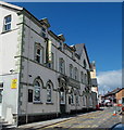
Lowan's Irish Bar, Bargoed
The Hanbury Road building in the town centre was formerly The Hanbury Arms. http://www.geograph.org.uk/photo/1152642
Image: © Jaggery
Taken: 15 May 2013
0.05 miles
8
Southeast end of West Street, Bargoed
West Street descends towards Hanbury Road. Club Lennox https://www.geograph.org.uk/photo/5751312 is on the right.
Image: © Jaggery
Taken: 25 Apr 2018
0.05 miles
9
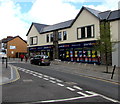
Poundworld Bargoed
Discount store in Units 1 & 2, Lowry Plaza, Hanbury Road, Bargoed.
Image: © Jaggery
Taken: 25 Apr 2018
0.05 miles
10
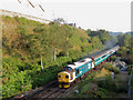
Class 37 at Bargoed
Class 37 locomotive No. 37025 is seen shortly after departing Bargoed with the 07:24 Rhymney to Cardiff Central working; classmate No. 37421 is on the rear.
Image: © Gareth James
Taken: 26 Aug 2019
0.05 miles