
IMAGES TAKEN NEAR TO
Park Crescent, BARGOED, CF81 8PL
Introduction
This page details the photographs taken nearby to Park Crescent, CF81 8PL by members of the Geograph project.
The Geograph project started in 2005 with the aim of publishing, organising and preserving representative images for every square kilometre of Great Britain, Ireland and the Isle of Man.

There are currently over 7.5m images from over14,400 individuals and you can help contribute to the project by visiting https://www.geograph.org.uk
Image Map
Images are licensed for reuse under creativecommons.org/licenses/by-sa/2.0
Notes
- Clicking on the map will re-center to the selected point.
- The higher the marker number, the further away the image location is from the centre of the postcode.
Image Listing (150 Images Found)
Images are licensed for reuse under creativecommons.org/licenses/by-sa/2.0
Image
Details
Distance
1
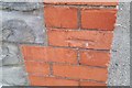
Ordnance Survey Cut Mark
This OS cut mark can be found on the east angle of the school. It marks a point 223.650m above mean sea level.
Image: © Adrian Dust
Taken: 31 Aug 2019
0.02 miles
2
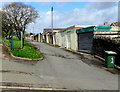
Lockup garages in Bargoed
At the rear of Park Crescent houses, viewed from Park Drive.
Image: © Jaggery
Taken: 25 Apr 2018
0.03 miles
3
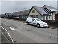
Park Primary School, Bargoed
Viewed across Park Crescent.
Image: © Jaggery
Taken: 25 Apr 2018
0.03 miles
4
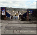
Entrance to Park Primary School, Bargoed
From Park Crescent. Maximum speed 5 mph. This way for the staff car park and for deliveries.
Image: © Jaggery
Taken: 25 Apr 2018
0.03 miles
5
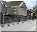
Warning sign - humps ahead, Park Crescent, Bargoed
On the approach to the Park Drive junction, the bilingual sign shows that Humps is Twmpathau in Welsh.
Image: © Jaggery
Taken: 25 Apr 2018
0.04 miles
6
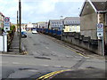
Start of the 20 zone, Park Crescent, Bargoed
The 30mph speed limit on Park Drive drops to 20mph on Park Crescent on the approach to Park Primary School.
Image: © Jaggery
Taken: 25 Apr 2018
0.04 miles
7
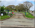
Entrance to Bargoed RFC car park from Park Drive, Bargoed
The car park is in a corner of Bargoed Park, the home ground of Bargoed RFC (Rugby Football Club).
Image: © Jaggery
Taken: 25 Apr 2018
0.05 miles
8
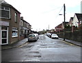
A straight Crescent in Bargoed
Park Crescent is strangely named. Usually, a street named a crescent has a course more or less resembling a curved shape like the moon in its first or last quarter, whereas here Park Crescent follows a straight course from Upper Wood Street on the camera side to Park Drive.
Image: © Jaggery
Taken: 25 Apr 2018
0.05 miles
9
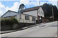
Bargoed Methodist Church, Bargoed
The Park Drive side of the church on the corner of Heol Fargoed.
Bargoed Methodist Church is part of the Mid Glamorgan Mission Methodist Circuit.
Image: © Jaggery
Taken: 25 Apr 2018
0.06 miles
10
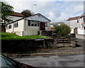
Bargoed Methodist Church, Bargoed
The Heol Fargoed side of the church on the corner of Park Drive.
Bargoed Methodist Church is part of the Mid Glamorgan Mission Methodist Circuit.
Image: © Jaggery
Taken: 25 Apr 2018
0.06 miles