1
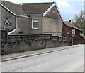
Bargoed Methodist Church, Bargoed
The Park Drive side of the church on the corner of Heol Fargoed.
Bargoed Methodist Church is part of the Mid Glamorgan Mission Methodist Circuit.
Image: © Jaggery
Taken: 25 Apr 2018
0.00 miles
2
Bargoed Methodist Church, Bargoed
The Heol Fargoed side of the church on the corner of Park Drive.
Bargoed Methodist Church is part of the Mid Glamorgan Mission Methodist Circuit.
Image: © Jaggery
Taken: 25 Apr 2018
0.01 miles
3
Entrance to Bargoed RFC car park from Park Drive, Bargoed
The car park is in a corner of Bargoed Park, the home ground of Bargoed RFC (Rugby Football Club).
Image: © Jaggery
Taken: 25 Apr 2018
0.03 miles
4
Start of the 20 zone, Park Crescent, Bargoed
The 30mph speed limit on Park Drive drops to 20mph on Park Crescent on the approach to Park Primary School.
Image: © Jaggery
Taken: 25 Apr 2018
0.03 miles
5
Lockup garages in Bargoed
At the rear of Park Crescent houses, viewed from Park Drive.
Image: © Jaggery
Taken: 25 Apr 2018
0.03 miles
6
Warning sign - humps ahead, Park Crescent, Bargoed
On the approach to the Park Drive junction, the bilingual sign shows that Humps is Twmpathau in Welsh.
Image: © Jaggery
Taken: 25 Apr 2018
0.03 miles
7
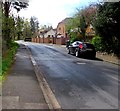
South along Heol Fargoed, Bargoed
From the corner of Park Drive. Bargoed Methodist Church https://www.geograph.org.uk/photo/5751573 is behind the camera.
Image: © Jaggery
Taken: 25 Apr 2018
0.05 miles
8
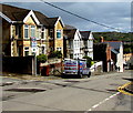
Park Drive houses, Bargoed
Between Park Crescent (on the left) and John Street.
Image: © Jaggery
Taken: 25 Apr 2018
0.06 miles
9
Oakland Gardens, Bargoed
Cul-de-sac on the south side of Park Drive.
Image: © Jaggery
Taken: 25 Apr 2018
0.06 miles
10
Ordnance Survey Cut Mark
This OS cut mark can be found on the east angle of the school. It marks a point 223.650m above mean sea level.
Image: © Adrian Dust
Taken: 31 Aug 2019
0.06 miles


