
IMAGES TAKEN NEAR TO
Ruth Street, BARGOED, CF81 8PE
Introduction
This page details the photographs taken nearby to Ruth Street, CF81 8PE by members of the Geograph project.
The Geograph project started in 2005 with the aim of publishing, organising and preserving representative images for every square kilometre of Great Britain, Ireland and the Isle of Man.

There are currently over 7.5m images from over14,400 individuals and you can help contribute to the project by visiting https://www.geograph.org.uk
Image Map
Images are licensed for reuse under creativecommons.org/licenses/by-sa/2.0
Notes
- Clicking on the map will re-center to the selected point.
- The higher the marker number, the further away the image location is from the centre of the postcode.
Image Listing (196 Images Found)
Images are licensed for reuse under creativecommons.org/licenses/by-sa/2.0
Image
Details
Distance
1
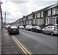
On-street parking, Ruth Street, Bargoed
Looking south along Ruth Street from near the Wood Street/Upper Wood Street intersection.
Image: © Jaggery
Taken: 25 Apr 2018
0.01 miles
2
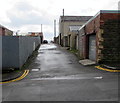
Wood Street Lane, Bargoed
Back lane on the south side of Wood Street.
Image: © Jaggery
Taken: 25 Apr 2018
0.02 miles
3
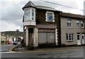
Derelict former shop on a Bargoed corner
On the corner of Ruth Street and Wood Street viewed in April 2018. This corner
has been derelict for many years - an August 2011 Google Earth Street View shows a similar scene.
Image: © Jaggery
Taken: 25 Apr 2018
0.03 miles
4
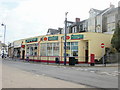
Bargoed Post Office
Post office and convenience store at 10 Cardiff Road.
Update May 2018. The post office has a new look. https://www.geograph.org.uk/photo/5751217
Image: © Jaggery
Taken: 7 May 2010
0.03 miles
5
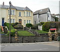
The Settlement, Cardiff Road, Bargoed
The noticeboard states "Meeting rooms available to the public".
Current occupiers include Bargoed Town Council, Rhymney Valley Home Start, and Bargoed Camera Club (meetings Wednesday evenings 7.30 to 9.30).
Image: © Jaggery
Taken: 7 May 2010
0.03 miles
6
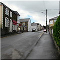
From Wood Street to Upper Wood Street, Bargoed
The STOP sign is on the corner of the Ruth Street intersection where Wood Street on the camera side becomes Upper Wood Street on the ascent towards Bargoed Park.
Image: © Jaggery
Taken: 25 Apr 2018
0.04 miles
7
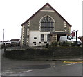
Former Bargoed Methodist Chapel, Wood Street, Bargoed
In April 2018, the chapel dated 1906 is the private chapel of funeral directors D J Thomas & Son.
Image: © Jaggery
Taken: 25 Apr 2018
0.04 miles
8
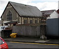
Private chapel, Wood Street, Bargoed
In April 2018 this is the private chapel of funeral directors D J Thomas & Son.
The building dated 1906 was formerly Bargoed Methodist Chapel.
Image: © Jaggery
Taken: 25 Apr 2018
0.04 miles
9
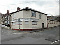
Bargoed Labour Club & Institute
Located at 1a Upper Wood Street, on the corner of Ruth Street.
Image: © Jaggery
Taken: 7 May 2010
0.04 miles
10
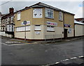
Bargoed Labour Club
On the corner of Upper Wood Street and Ruth Street viewed in April 2018.
The club name and the exterior of the building have changed since this https://www.geograph.org.uk/photo/1848281 May 2010 photo.
Image: © Jaggery
Taken: 25 Apr 2018
0.04 miles