
IMAGES TAKEN NEAR TO
William Street, BARGOED, CF81 8ND
Introduction
This page details the photographs taken nearby to William Street, CF81 8ND by members of the Geograph project.
The Geograph project started in 2005 with the aim of publishing, organising and preserving representative images for every square kilometre of Great Britain, Ireland and the Isle of Man.

There are currently over 7.5m images from over14,400 individuals and you can help contribute to the project by visiting https://www.geograph.org.uk
Image Map
Images are licensed for reuse under creativecommons.org/licenses/by-sa/2.0
Notes
- Clicking on the map will re-center to the selected point.
- The higher the marker number, the further away the image location is from the centre of the postcode.
Image Listing (161 Images Found)
Images are licensed for reuse under creativecommons.org/licenses/by-sa/2.0
Image
Details
Distance
1
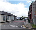
William Street, Gilfach
Viewed from the corner of the short access road to the Bargoed Fire Station. http://www.geograph.org.uk/photo/3463055
There is a row of 8 houses on the west side of the street and offices on the east side.
Gilfach House http://www.geograph.org.uk/photo/3463056 is at the far end of the street.
Image: © Jaggery
Taken: 15 May 2013
0.01 miles
2
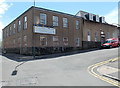
PC Mobility Services showroom, Gilfach
The premises are located between Park Place and William Street, near the fire station. http://www.geograph.org.uk/photo/3463055
PC Mobility Services specialise in the sale and repair of mobility equipment and mobility aids.
Image: © Jaggery
Taken: 15 May 2013
0.02 miles
3
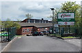
Entrance to Gilfach House council offices, Gilfach
This is Caerphilly County Borough Council's Upper Rhymney Valley Area Housing Office, located in William Street. http://www.geograph.org.uk/photo/3463061
Image: © Jaggery
Taken: 15 May 2013
0.03 miles
4
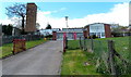
Bargoed Fire Station, Gilfach
The fire station, though named Bargoed, is located in the adjoining village of Gilfach, set back from the corner of William Street. It is part of the South Wales Fire and Rescue Service.
This http://www.geograph.org.uk/photo/467177 is how the station looked in 2007.
Image: © Jaggery
Taken: 15 May 2013
0.04 miles
5
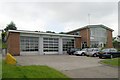
Bargoed Fire Station
Bargoed Fire Station, William Street, Gilfach, Bargoed - one of the stations run by South Wales Fire & Rescue Service. When this picture was taken, the station was threatened with possible closure.
Image: © Kevin Hale
Taken: 4 Jun 2007
0.04 miles
6
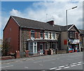
Park Place houses and shop, Gilfach
The shop is Valley News & Stores, 45 Park Place.
Image: © Jaggery
Taken: 15 May 2013
0.06 miles
7
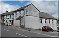
Gilfach Workingmen's Club
The club is at 87-89 Park Place.
Image: © Jaggery
Taken: 15 May 2013
0.07 miles
8
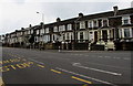
West side of Park Place, Gilfach
Stone houses on the west side of Park Place viewed from The Capel pub & hotel bus stop.
Image: © Jaggery
Taken: 1 May 2019
0.07 miles
9
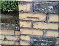
Ordnance Survey Cut Mark
This OS cut mark can be found on the wall of No29 Hillside Park. It marks a point 211.290m above mean sea level.
Image: © Adrian Dust
Taken: 31 Aug 2019
0.08 miles
10
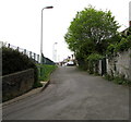
South along Angel Lane, Gilfach
Towards Aeron Place.
Image: © Jaggery
Taken: 1 May 2019
0.09 miles