1
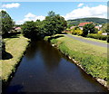
Upstream along the Ely, Pontyclun
The Ely River (Afon Elai in Welsh) flows towards this http://www.geograph.org.uk/photo/4499303 bridge. About 30 metres
behind the bridge, its waters are augmented at the confluence http://www.geograph.org.uk/photo/4499323 with the Afon Clun.
Image: © Jaggery
Taken: 5 Jun 2014
0.09 miles
2
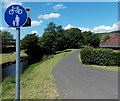
Riverside footpath and cycleway, Pontyclun
From the street named Ynysddu, the route along a bank of the River
Ely heads west towards Coedely (3 miles) and Tonyrefail (5 miles).
Image: © Jaggery
Taken: 5 Jun 2014
0.09 miles
3
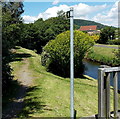
Riverside footpath, Pontyclun
Along a bank of the Ely River from the street named Ynysddu.
Image: © Jaggery
Taken: 5 Jun 2014
0.10 miles
4
Entrance to Y Pant School
Image: © John Lord
Taken: 1 Dec 2017
0.12 miles
5
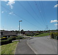
Wires over Ynysddu, Pontyclun
Ynysddu is an area of modern houses west of the Ely River in Pontyclun.
Image: © Jaggery
Taken: 5 Jun 2014
0.12 miles
6
Ynysddu road bridge over the River Ely in Pontyclun
The street named Ynysddu crosses the river. The A4222 junction is a few metres out of shot ahead.
Image: © Jaggery
Taken: 5 Jun 2014
0.12 miles
7
Welsh Water lorry in Pontyclun
On the corner of the A4222 and the street named Ynysddu, near the River Ely.
Image: © Jaggery
Taken: 5 Jun 2014
0.12 miles
8
Ynysddu leading to Clos Ynysddu, Pontyclun
From the corner of the A4222, the road ahead crosses the River Ely. Beyond is a large area of modern houses. Although the street names on the sign are in Welsh only, no Welsh equivalent of LEADING TO is shown.
Image: © Jaggery
Taken: 5 Jun 2014
0.12 miles
9
Bridge over the Clun, Pontyclun
Image: © John Lord
Taken: 1 Dec 2017
0.14 miles
10
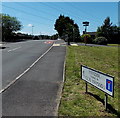
Northern boundary of Pontyclun
The A4222 Llantrisant Road passes the boundary sign showing the Welsh language hyphenated form of the name spelt Pontyclun in English. A bridge carries the road over the Clun a few metres from its confluence http://www.geograph.org.uk/photo/4017170 with the Ely.
Image: © Jaggery
Taken: 5 Jun 2014
0.15 miles


