IMAGES TAKEN NEAR TO
St. Peters Close, PONTYCLUN, CF72 9SD
Introduction
This page details the photographs taken nearby to St. Peters Close, CF72 9SD by members of the Geograph project.
The Geograph project started in 2005 with the aim of publishing, organising and preserving representative images for every square kilometre of Great Britain, Ireland and the Isle of Man.

There are currently over 7.5m images from over14,400 individuals and you can help contribute to the project by visiting https://www.geograph.org.uk
Image Map
Images are licensed for reuse under creativecommons.org/licenses/by-sa/2.0
Notes
- Clicking on the map will re-center to the selected point.
- The higher the marker number, the further away the image location is from the centre of the postcode.
Image Listing (22 Images Found)
Images are licensed for reuse under creativecommons.org/licenses/by-sa/2.0
Image
Details
Distance
2
Northern end of Coed Bychan Crescent, Llanharan
Viewed from Grove Terrace.
Image: © Jaggery
Taken: 19 Jun 2014
0.08 miles
3
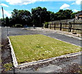
Public space, Grove Terrace, Llanharan
A grass rectangle and benches on the west side of the road.
Image: © Jaggery
Taken: 19 Jun 2014
0.15 miles
4
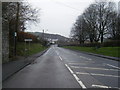
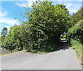
Brynna Road at Llanharan village boundary
Image: © Colin Pyle
Taken: 16 Dec 2013
0.17 miles
5
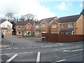
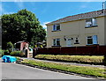
St James Mews, Llanharan
Modern housing viewed across Brynna Road.
Image: © Jaggery
Taken: 12 Feb 2011
0.18 miles
6
Coed Bychan Crescent, Llanharan
Looking SE towards Hillside Avenue.
Image: © Jaggery
Taken: 19 Jun 2014
0.18 miles
7
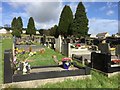
Brynna Cemetery
Llanharan Cemetery, Brynna.
Image: © Alan Hughes
Taken: 9 Mar 2017
0.19 miles

9
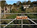
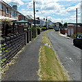
Blocked NW end of Chapel Hill, Llanharan
Viewed from the corner of Chapel Hill Close. http://www.geograph.org.uk/photo/4034936
Overlapping metal barriers prevent the passagee of vehicles. Walkers can pass between the barriers.
Image: © Jaggery
Taken: 19 Jun 2014
0.19 miles
10
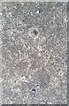
Ordnance Survey Rivet
This OS rivet can be found on the bottom step (now flush with pavement) leading into the cemetery. It marks a point 100.755m above mean sea level.
Image: © Adrian Dust
Taken: 28 Apr 2018
0.19 miles