1
Ordnance Survey Cut Mark
This OS cut mark can be found on the wall of the chapel. It marks a point 72.021m above mean sea level.
Image: © Adrian Dust
Taken: 28 Apr 2018
0.03 miles
2
The former Bethlemhem chapel, Llanharan
Image: © Gareth James
Taken: 7 Jan 2018
0.03 miles
3
Former Bethlehem Chapel, Llanharan
The original Bethlehem Independent Chapel was built before 1780, rebuilt in 1837 and again in 1895.
Now in residential use, viewed in June 2014, this Chapel Road building closed as a chapel in the 1990s.
Image: © Jaggery
Taken: 19 Jun 2014
0.03 miles
4
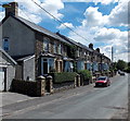
Chapel Road houses, Llanharan
Between the Tredegar Avenue junction on the right and the Bethlehem View junction out of shot ahead.
Image: © Jaggery
Taken: 19 Jun 2014
0.04 miles
5
Row of houses, Chapel Road, Llanharan
Viewed from the Chapel Hill end looking ESE.
Image: © Jaggery
Taken: 19 Jun 2014
0.04 miles
6
Bethlehem View houses, Llanharan
Houses set below Chapel Road, near the former Bethlehem chapel. http://www.geograph.org.uk/photo/4034912
Image: © Jaggery
Taken: 19 Jun 2014
0.06 miles
7
Ordnance Survey Rivet
This OS rivet can be found at the entrance from Chapel Road to the Play Ground. It marks a point 79.099m above mean sea level.
Image: © Adrian Dust
Taken: 28 Apr 2018
0.07 miles
8
St James Mews, Llanharan
Modern housing viewed across Brynna Road.
Image: © Jaggery
Taken: 12 Feb 2011
0.07 miles
9
Trio of No Through Road signs in Llanharan
Alongside Church Road at the Tredegar Avenue junction, http://www.geograph.org.uk/photo/4034916 on the approach to Chapel Hill.
Perhaps there are two signs on the left because the one on the right is liable to have the hedge grow around it.
Image: © Jaggery
Taken: 19 Jun 2014
0.07 miles
10
Southern end of Tredegar Avenue, Llanharan
From Chapel Road.
Image: © Jaggery
Taken: 19 Jun 2014
0.07 miles


