1
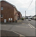
Housing variety, Llanharry Road, Llanharry
Row of houses on the right. Semi-detached houses on the left.
Image: © Jaggery
Taken: 13 Apr 2021
0.01 miles
2
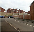
Junction of Llys Joseph and Llanharry Road, Llanharry
From the left, the road named Llys Joseph joins Llanharry Road.
Image: © Jaggery
Taken: 13 Apr 2021
0.02 miles
3
Brick houses beyond a building site in Llanharry
On the north side of Llanharry Road west of this https://www.geograph.org.uk/photo/6809228 building site viewed in April 2021.
Image: © Jaggery
Taken: 13 Apr 2021
0.02 miles
4
Brick houses on the north side of Llanharry Road, Llanharry
Looking past the Llys Joseph junction in April 2021.
Image: © Jaggery
Taken: 13 Apr 2021
0.03 miles
5
Llanharry Road semis, Llanharry
Semi-detached houses on the south side of Llanharry Road.
Image: © Jaggery
Taken: 13 Apr 2021
0.04 miles
6
Llys Joseph brick houses, Llanharry
Looking north along the road name Llys Joseph from the corner of Llanharry Road.
Image: © Jaggery
Taken: 13 Apr 2021
0.04 miles
7
Junction of The Patch and Llanharry Road, Llanharry
From the left, the cul-de-sac named The Patch joins Llanharry Road.
Image: © Jaggery
Taken: 13 Apr 2021
0.05 miles
8
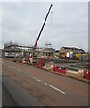
Crane in a construction site, Llanharry
Viewed across Llanharry Road in April 2021.
Image: © Jaggery
Taken: 13 Apr 2021
0.05 miles
9
Up The Patch, Llanharry
Looking across Llanharry Road up the cul-de-sac named The Patch towards a white 21st century house in April 2021. The house was not in an August 2009 Google Street View.
Image: © Jaggery
Taken: 13 Apr 2021
0.06 miles
10
Houses in The Patch, Llanharry
The Patch is a cul-de-sac connecting with Llanharry Road behind the camera.
A yellow Neighbourhood Watch Area notice is on the lamppost on the left.
Image: © Jaggery
Taken: 13 Apr 2021
0.06 miles


