1
Llanharry Road, Brynsadler
Viewed from the A4222 Cowbridge Road. A sign on the right shows 1 (mile) to Llanharry.
Image: © Jaggery
Taken: 12 Jun 2014
0.08 miles
2
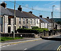
Cowbridge Road houses, Brynsadler
Looking NNE from opposite the Llanharry Road junction. http://www.geograph.org.uk/photo/4023407
Image: © Jaggery
Taken: 12 Jun 2014
0.08 miles
3
Former Brynsadler post office
A postbox remains in front of 49 Cowbridge Road, formerly the village post office.
Image: © Jaggery
Taken: 12 Jun 2014
0.09 miles
4
A4222 through Brynsadler
Image: © Mick Lobb
Taken: 8 Jul 2008
0.09 miles
5
Iggle Piggle Cottage, Brynsadler
On the corner of Cowbridge Road and High Street. On the right is the former Capel Sion http://www.geograph.org.uk/photo/4023384
High Street on the left is curiously named. It is a short residential cul-de-sac with no shops.
Image: © Jaggery
Taken: 12 Jun 2014
0.10 miles
6
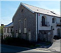
Converted former Capel Sion in Brynsadler
Viewed across the A4222 Cowbridge Road from the corner of Llanharry Road.
The inscription on a tablet on the wall shows CAPEL SION 1863.
Image: © Jaggery
Taken: 12 Jun 2014
0.10 miles
7
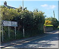
Distances from Brynsadler
The sign is alongside the A4222 Cowbridge Road opposite the eastern end of Llanharry Road. http://www.geograph.org.uk/photo/4023407
Left (north) for Talbot Green (1½ miles) and Llantrisant (2), right for Cowbridge (5).
Image: © Jaggery
Taken: 12 Jun 2014
0.10 miles
8
Cowbridge Road side of The Ivor Arms, Brynsadler
This side of the pub extends are far as the first chimney on the right.
http://www.geograph.org.uk/photo/4023292 to The Hollies side of the pub.
Image: © Jaggery
Taken: 12 Jun 2014
0.11 miles
9
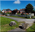
Clos Brenin houses in Brynsadler
Viewed from the edge of the A4222 Cowbridge Road.
Image: © Jaggery
Taken: 12 Jun 2014
0.12 miles
10
North side of The Ivor Arms, Brynsadler
Viewed across the street named The Hollies. http://www.geograph.org.uk/photo/4023284 to the Cowbridge Road side of the pub.
Image: © Jaggery
Taken: 12 Jun 2014
0.12 miles


