IMAGES TAKEN NEAR TO
Hensol Road, PONTYCLUN, CF72 8JT

Introduction

This page details the photographs taken nearby to Hensol Road, CF72 8JT by members of the Geograph project.

The Geograph project started in 2005 with the aim of publishing, organising and preserving representative images for every square kilometre of Great Britain, Ireland and the Isle of Man.

There are currently over 7.5m images from over14,400 individuals and you can help contribute to the project by visiting https://www.geograph.org.uk

Image Map


Images are licensed for reuse under creativecommons.org/licenses/by-sa/2.0
Notes
  • Clicking on the map will re-center to the selected point.
  • The higher the marker number, the further away the image location is from the centre of the postcode.

Image Listing (62 Images Found)

Images are licensed for reuse under creativecommons.org/licenses/by-sa/2.0
  • ...
Image
Details
Distance
1
April Cottage, Hensol Road, Miskin
April Cottage is on the left.
Image: © Jaggery Taken: 29 Aug 2017
0.01 miles
2
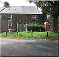
A terrace on Hensol Road, Miskin
Image: © Mick Lobb Taken: 10 Feb 2009
0.01 miles
3
Hensol Road, Miskin
The sign on the left shows that Hensol Road is unsuitable for heavy goods vehicles.
Image: © Jaggery Taken: 29 Aug 2017
0.01 miles
4
Cottages in Hensol Rd, Miskin
Image: © John Lord Taken: 1 Dec 2017
0.01 miles
5
War memorial and Miskin Arms
Image: © Gareth James Taken: 4 Jun 2011
0.01 miles
6
Hensol Road cottages, Miskin
Image: © Gareth James Taken: 4 Jun 2011
0.01 miles
7
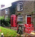
West side of Hensol Road, Miskin
Temporary barriers are in place on August 29th 2017 during roadworks.
Image: © Jaggery Taken: 29 Aug 2017
0.01 miles
8
War Memorial, Miskin
Image: © Mick Lobb Taken: 10 Feb 2009
0.02 miles
9
Grade II listed phonebox, Hensol Road, Miskin
The K6 type red box was Grade II listed in 2000.
Image: © Jaggery Taken: 29 Aug 2017
0.02 miles
10
Hensol Road, Miskin
The road leads up to cross a railway bridge before entering the village.
Image: © Mick Lobb Taken: 10 Feb 2009
0.02 miles
  • ...