
IMAGES TAKEN NEAR TO
Lanelay Road, PONTYCLUN, CF72 8HY
Introduction
This page details the photographs taken nearby to Lanelay Road, CF72 8HY by members of the Geograph project.
The Geograph project started in 2005 with the aim of publishing, organising and preserving representative images for every square kilometre of Great Britain, Ireland and the Isle of Man.

There are currently over 7.5m images from over14,400 individuals and you can help contribute to the project by visiting https://www.geograph.org.uk
Image Map
Images are licensed for reuse under creativecommons.org/licenses/by-sa/2.0
Notes
- Clicking on the map will re-center to the selected point.
- The higher the marker number, the further away the image location is from the centre of the postcode.
Image Listing (43 Images Found)
Images are licensed for reuse under creativecommons.org/licenses/by-sa/2.0
Image
Details
Distance
1
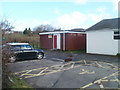
ACF hut, Talbot Green
The Army Cadet Force (ACF) hut is alongside Talbot Green Pavilion, http://www.geograph.org.uk/photo/2305425 Lanelay Road.
The ACF Talbot Green Detachment is part of C Company (Bridgend & Pontypridd).
Image: © Jaggery
Taken: 12 Feb 2011
0.03 miles
2
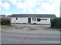
Talbot Green Pavilion
Sports pavilion and community centre, Lanelay Road, at the NE corner of a football pitch. http://www.geograph.org.uk/photo/2305418
Image: © Jaggery
Taken: 12 Feb 2011
0.03 miles
4
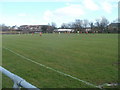
Oranges versus Yellows, Talbot Green
A Saturday afternoon football match is being played on a pitch on the south side of Lanelay Road.
Image: © Jaggery
Taken: 12 Feb 2011
0.08 miles
5
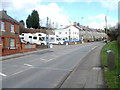
Freewheel Leisure, Talbot Green
Located in a gap in the houses on the north side of Lanelay Road.
Freewheel Leisure buy and sell motorhomes, specialising in those built in Germany from 1994 onwards.
Image: © Jaggery
Taken: 12 Feb 2011
0.10 miles
6
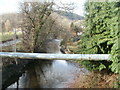
Pipe across the Ely, Talbot Green
Viewed from Lanelay Road. A large-bore pipe crosses above the Ely River.
Image: © Jaggery
Taken: 12 Feb 2011
0.12 miles
7
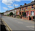
West along Lanelay Road, Talbot Green
The houses are on the north side of Lanelay Road.
Image: © Jaggery
Taken: 31 Aug 2017
0.15 miles
8
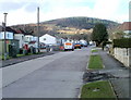
Forest Hills Drive, Talbot Green
Viewed from the Lanelay Road end.
Image: © Jaggery
Taken: 12 Feb 2011
0.16 miles
9
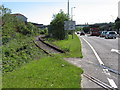
Former railway line near Pontyclun
The track is still in place over the level crossing on the A473 here, but the rails themselves end just a few metres further on.
Image: © Gareth James
Taken: 4 Jun 2011
0.16 miles
10
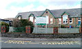
Tonysguboriau Primary School, Talbot Green
Viewed from Cowbridge Road. The school has about 220 pupils, aged 3 to 11.
Tonysguboriau is the Welsh name http://www.geograph.org.uk/photo/2305407 for Talbot Green.
Image: © Jaggery
Taken: 12 Feb 2011
0.16 miles