1
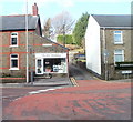
Tonysguboriau Primary School, Talbot Green
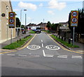
Viewed across Cowbridge Road speed bumps. Tonysguboriau is the Welsh name for Talbot Green.
Image: © Jaggery
Taken: 10 Jan 2018
0.05 miles
2
Tonysguboriau Primary School, Talbot Green
Viewed from Cowbridge Road. The school has about 220 pupils, aged 3 to 11.
Tonysguboriau is the Welsh name http://www.geograph.org.uk/photo/2305407 for Talbot Green.
Image: © Jaggery
Taken: 12 Feb 2011
0.06 miles
3
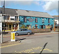
The Art Workshop, Talbot Green
Located at 1 Lanelay Road, facing Talbot Square. Opened in 2005, The Art Workshop specialises in bespoke picture framing. In addition, many varieties of ready-made frames and a large selection of mouldings are for sale. The business also sells prints, paintings, ornaments, figurines, and various other items.
Image: © Jaggery
Taken: 12 Feb 2011
0.06 miles
4
The Talbot Arms, Talbot Green
This was the first building erected in the new village of Talbot Green, in 1859.
It was named in honour of the landowner, Sir Charles Chetwynd Talbot, second Earl Talbot of Hensol.
Image: © Jaggery
Taken: 12 Feb 2011
0.08 miles
5
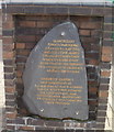
Llantrisant ancient boundary, Talbot Green
Located in front of Talbot Green Post Office. http://www.geograph.org.uk/photo/2305473
The text is in Welsh and English. The English text is
LLANTRISANT
TOWN'S CHARTER WAS
GRANTED 4th MAY 1346
AND THIS STONE MARKS
THE ANCIENT BOUNDARY
WHICH IS WALKED EVERY
SEVEN YEARS BY THE FREEMEN
OF LLANTRISANT TO CELEBRATE
BEATING THE BOUNDS.
Image: © Jaggery
Taken: 12 Feb 2011
0.08 miles
6
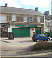
Talbot Green Post Office
Located at 12-14 Stuart Terrace, Talbot Square, Talbot Green. Viewed on a Saturday afternoon. The post office closed at 12.30pm today. On Mondays-Fridays, it is open from 9am to 5.30pm.
A stone http://www.geograph.org.uk/photo/2305482 in front of the post office marks an ancient boundary.
Image: © Jaggery
Taken: 12 Feb 2011
0.08 miles
7
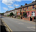
West along Lanelay Road, Talbot Green
The houses are on the north side of Lanelay Road.
Image: © Jaggery
Taken: 31 Aug 2017
0.08 miles
8
Houses, Lanelay Rd, Talbot Green
Image: © John Lord
Taken: 1 Dec 2017
0.09 miles
9
Freewheel Leisure, Talbot Green
Located in a gap in the houses on the north side of Lanelay Road.
Freewheel Leisure buy and sell motorhomes, specialising in those built in Germany from 1994 onwards.
Image: © Jaggery
Taken: 12 Feb 2011
0.09 miles
10
Heol Johnson, Talbot Green
The 20mph speed limit on Cowbridge Road near a school increases to 30mph along Heol Johnson.
No motor vehicles ahead except for access.
Image: © Jaggery
Taken: 31 Aug 2017
0.09 miles


