
IMAGES TAKEN NEAR TO
Erw Hir, PONTYCLUN, CF72 8BY
Introduction
This page details the photographs taken nearby to Erw Hir, CF72 8BY by members of the Geograph project.
The Geograph project started in 2005 with the aim of publishing, organising and preserving representative images for every square kilometre of Great Britain, Ireland and the Isle of Man.

There are currently over 7.5m images from over14,400 individuals and you can help contribute to the project by visiting https://www.geograph.org.uk
Image Map
Images are licensed for reuse under creativecommons.org/licenses/by-sa/2.0
Notes
- Clicking on the map will re-center to the selected point.
- The higher the marker number, the further away the image location is from the centre of the postcode.
Image Listing (70 Images Found)
Images are licensed for reuse under creativecommons.org/licenses/by-sa/2.0
Image
Details
Distance
1
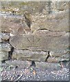
Ordnance Survey Cut Mark
This inverted OS cut mark can be found on the wall at the junction of Cardiff Road and Cross Inn Road. It marks a point 89.444m above mean sea level.
Image: © Adrian Dust
Taken: 19 Sep 2021
0.09 miles
2
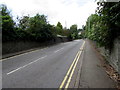
No parking on Cross Inn Road, Llantrisant
Double yellow lines on both sides indicate no parking at any time.
Image: © Jaggery
Taken: 31 Aug 2017
0.09 miles
3
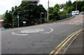
Mini-roundabout in Llantrisant
At the junction of Cross Inn Road and Cardiff Road.
Image: © Jaggery
Taken: 31 Aug 2017
0.09 miles
4
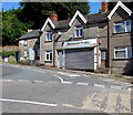
Shuttered shop at the SE end of High Street, Llantrisant
Closed and shuttered at 11:20 am on Thursday August 31st 2017.
Image: © Jaggery
Taken: 31 Aug 2017
0.10 miles
5
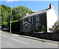
Tŷ Plocyn, Cardiff Road, Llantrisant
Stone house near the Cross Inn Road junction.
Image: © Jaggery
Taken: 31 Aug 2017
0.10 miles
6
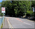
Warning sign - humps ahead to the left and right, Cardiff Road, Llantrisant
Facing northbound traffic on the approach to the Cross Inn Road junction.
Twmpathau is Welsh for Humps.
Image: © Jaggery
Taken: 31 Aug 2017
0.10 miles
7
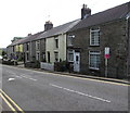
Row of houses, Cross Inn Road, Llantrisant
Viewed past a speed bump.
Image: © Jaggery
Taken: 31 Aug 2017
0.10 miles
8
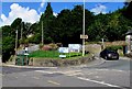
Hairpin bend in the B4595, Llantrisant
The car is ascending the B4595 High Street towards the town centre.
The B4595 on the left descends towards Talbot Green.
Image: © Jaggery
Taken: 31 Aug 2017
0.10 miles
9
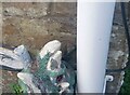
Ordnance Survey Cut Mark
This OS cut mark can be found on No8 Cross Inn Road. It marks a point 78.645m above mean sea level.
Image: © Adrian Dust
Taken: 19 Sep 2021
0.11 miles
10
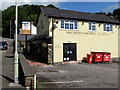
The Penny Farthing in Llantrisant
Pub on the east side of Cardiff Road, near Llantrisant Leisure Centre. http://www.geograph.org.uk/photo/5521609 to the name sign.
Image: © Jaggery
Taken: 31 Aug 2017
0.11 miles