1
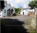
Main Road, Peygawsi
Looking towards Cross Inn.
Image: © Duncan and Gareth Alderson
Taken: 15 Jun 2008
0.01 miles
2
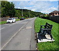
Main Road bench, Llantrisant
Viewed on August 31st 2017. The recently installed bench has
replaced the green one seen in a June 2011 Google Earth Street View .
Image: © Jaggery
Taken: 31 Aug 2017
0.02 miles
3
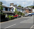
Main Road houses in Llantrisant near Cross Inn
The houses are between The Brambles and Taff Cottages.
Image: © Jaggery
Taken: 31 Aug 2017
0.03 miles
4
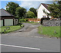
Taff Cottages Llantrisant near Cross Inn
Viewed across Main Road. The sign on the grass shows TAFF COTTAGES.
A sign in the background shows PRIVATE ROAD.
Image: © Jaggery
Taken: 31 Aug 2017
0.04 miles
5
Cottesmore Way houses, Cross Inn
Cross Inn in the county borough of Rhondda Cynon Taf is an area in the south of Llantrisant.
Image: © Jaggery
Taken: 31 Aug 2017
0.04 miles
6
Entrance to Maes-yr-Haul Cottages, Penygawsi
The railway bridge carries the disused railway line between Pontyclun and Pontypridd.
Image: © Duncan and Gareth Alderson
Taken: 15 Jun 2008
0.08 miles
7
Taff Cottages, Penygawsi
Formerly a busy main road, now a minor road leading to Cefn-y-Parc Cemetery. The new A473 road bridge can be seen in the background.
Image: © Duncan and Gareth Alderson
Taken: 15 Jun 2008
0.09 miles
8
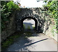
Low stone arch bridge, Cross Inn
Former railway bridge leading to Maes-yr-Haul Cottages.
Image: © Jaggery
Taken: 31 Aug 2017
0.10 miles
9
Maes-yr-Haul Cottages, Cross Inn
Accessed under this https://www.geograph.org.uk/photo/5669134 bridge.
Image: © Jaggery
Taken: 31 Aug 2017
0.10 miles
10
Westhill Drive, Llantrisant
East of the Westfield Court junction. http://www.geograph.org.uk/photo/5521790
Image: © Jaggery
Taken: 31 Aug 2017
0.11 miles


