1
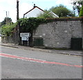
Two telecoms cabinets, Cross Inn Road, Cross Inn
The BT cabinet on the right is near a Virgin Media cabinet numbered 28.
Image: © Jaggery
Taken: 31 Aug 2017
0.01 miles
2
Ordnance Survey Cut Mark
This OS cut mark can be found on the NE buttress of the railway bridge on Cross Inn Road. It marks a point 59.058m above mean sea level.
Image: © Adrian Dust
Taken: 19 Sep 2021
0.01 miles
3
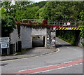
Underpass and bridge, Cross Inn Road, Cross Inn
The bridge formerly carried the railway near Cross Inn railway station.
Station and railway have both gone. Headroom shown is 12' 3"
A pedestrian underpass is on the left.
Image: © Jaggery
Taken: 31 Aug 2017
0.01 miles
4
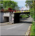
Cross Inn Road bridge, Cross Inn near Llantrisant
The bridge formerly carried the railway near Cross Inn railway station.
Station and railway have both gone. Headroom shown is 12' 3"
A pedestrian underpass is on the left.
Image: © Jaggery
Taken: 31 Aug 2017
0.01 miles
5
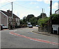
Bend in the road, Cross Inn
From Cross Inn Road to Main Road. Cross Inn in the county borough of Rhondda Cynon Taf is an area in the south of Llantrisant.
Image: © Jaggery
Taken: 31 Aug 2017
0.02 miles
6
Northwest side of Cross Inn Road bridge, Cross Inn near Llantrisant
The bridge formerly carried the railway near Cross Inn railway station.
Station and railway have both gone. Headroom shown is 12' 3".
The Cross Inn pub http://www.geograph.org.uk/photo/5520503 is in the background.
Image: © Jaggery
Taken: 31 Aug 2017
0.02 miles
7
Railway bridge and road junction, Cross Inn
The road ahead leads uphill to Llantrisant. The railway line has been disused for several years. There have been many incidents of high vehicles getting stuck or striking the bridge, but as there is the possibility of the passenger service being re-instated the bridge has not been dismantled.
Image: © Duncan and Gareth Alderson
Taken: 8 Jun 2008
0.02 miles
8
Cross Inn name sign near Llantrisant
Hanging from a wall bracket here. http://www.geograph.org.uk/photo/5520503
Image: © Jaggery
Taken: 31 Aug 2017
0.02 miles
9
Pill Box
Image: © Adrian Dust
Taken: 19 Sep 2021
0.02 miles
10
Southgate Garage (Llantrisant) Ltd, Cross Inn
Located in Old Station Yard above the corner of Main Road and Cross Inn Road.
Image: © Jaggery
Taken: 31 Aug 2017
0.02 miles


