1
Queen Elizabeth II postbox, Chapel Road, Broughton, Vale of Glamorgan
Located here. https://www.geograph.org.uk/photo/6252598
Image: © Jaggery
Taken: 30 Aug 2019
0.01 miles
2
Chapel Road bus shelter, Broughton, Vale of Glamorgan
Located here https://www.geograph.org.uk/photo/6252598 near the corner of West Street.
Image: © Jaggery
Taken: 30 Aug 2019
0.01 miles
3
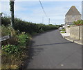
Chapel Road, Broughton, Vale of Glamorgan
From West Street, Chapel Road leads to Water Street.
Image: © Jaggery
Taken: 30 Aug 2019
0.02 miles
4
Broughton
Broughton, photo taken from a gritter cab; after following a quarry machine to open blocked roads from snow about week earlier, I had three days out in a gritter in this January 7th to January 10th; about a week later took my camera to work to get some pics.
Image: © Colin Prosser
Taken: Unknown
0.03 miles
5
The Malthouse, Broughton, Vale of Glamorgan.
Not sure of the history of this building on Water Street, but assume it was once a malthouse which has now been converted into apartments.
Image: © Peter Wasp
Taken: 21 Mar 2007
0.03 miles
6
'The Malthouse' Sign
Sign on the wall of the Malthouse, Broughton.
Image: © Alan Hughes
Taken: 19 Mar 2016
0.03 miles
7
The Old Malthouse
The Old Malthouse, Broughton.
Image: © Alan Hughes
Taken: 19 Mar 2016
0.03 miles
8
Tablet on the former Ebenezer Chapel, Broughton, Vale of Glamorgan
The tablet on this https://www.geograph.org.uk/photo/6252615 building shows
EBENEZER CALVINISTIC METHODIST CHAPEL - BUILT A.D. 1830 - REBUILT A.D. 1877.
Image: © Jaggery
Taken: 30 Aug 2019
0.03 miles
9
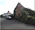
Former Ebenezer Chapel, Chapel Road, Broughton, Vale of Glamorgan
Viewed in August 2019. The building was converted to residential use many years ago. The tablet https://www.geograph.org.uk/photo/6252620 records that this was the 1877 rebuild of the original Ebenezer Calvinistic Methodist Chapel built in 1830.
Image: © Jaggery
Taken: 30 Aug 2019
0.03 miles
10
West along Water Street, Broughton
One of many places in the UK named Broughton, this one is a small village in the Vale of Glamorgan south of Wick.
Image: © Jaggery
Taken: 30 Aug 2019
0.04 miles


