
IMAGES TAKEN NEAR TO
Trepit Road, COWBRIDGE, CF71 7QL
Introduction
This page details the photographs taken nearby to Trepit Road, CF71 7QL by members of the Geograph project.
The Geograph project started in 2005 with the aim of publishing, organising and preserving representative images for every square kilometre of Great Britain, Ireland and the Isle of Man.

There are currently over 7.5m images from over14,400 individuals and you can help contribute to the project by visiting https://www.geograph.org.uk
Image Map
Images are licensed for reuse under creativecommons.org/licenses/by-sa/2.0
Notes
- Clicking on the map will re-center to the selected point.
- The higher the marker number, the further away the image location is from the centre of the postcode.
Image Listing (70 Images Found)
Images are licensed for reuse under creativecommons.org/licenses/by-sa/2.0
Image
Details
Distance
1
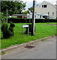
Topiary alongside Trepit Road, Wick
Shaped bush near the Trepit Road name sign.
Image: © Jaggery
Taken: 30 Aug 2019
0.01 miles
2
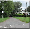
North along Heol Fain, Wick, Vale of Glamorgan
The 30mph speed limit on Trepit Road increases to the National Speed Limit on Heol Fain. Ahead for the B4265.
Image: © Jaggery
Taken: 30 Aug 2019
0.01 miles
3
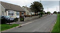
Trepit Road bungalows, Wick, Vale of Glamorgan
Derived from a Hindi word meaning in the style of Bengal, bungalow was originally used in English for a lightly-built house, with a veranda and one storey. In current UK usage it is a convenient word for any one-storey dwelling.
Image: © Jaggery
Taken: 30 Aug 2019
0.04 miles
4
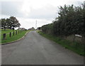
Chapel Road, Wick, Vale of Glamorgan
From the corner of Trepit Road along Chapel Road towards Broughton Road.
Image: © Jaggery
Taken: 30 Aug 2019
0.05 miles
5
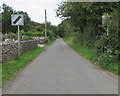
End of the 30 zone, Trepit Road near Wick
At the edge of Wick in the Vale of Glamorgan, the 30mph speed limit increases to the National Speed Limit.
Image: © Jaggery
Taken: 30 Aug 2019
0.08 miles
6
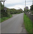
Start of the 30 zone, Trepit Road near Wick
On the approach to Wick in the Vale of Glamorgan, the National Speed Limit drops to 30mph.
Image: © Jaggery
Taken: 30 Aug 2019
0.08 miles
7
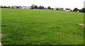
Green Uchaf, Wick, Vale of Glamorgan
Part of a triangular green viewed from Broughton Road.
Uchaf is Welsh for uppermost, topmost or highest.
Image: © Jaggery
Taken: 28 Aug 2019
0.08 miles
8
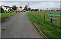
Chapel Road, Wick, Vale of Glamorgan
From Broughton Road along Chapel Road towards Trepit Road. Green Uchaf recreation area is on the right.
Image: © Jaggery
Taken: 30 Aug 2019
0.08 miles
9
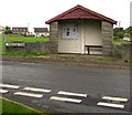
Broughton Road bus stop and shelter, Wick, Vale of Glamorgan
In August 2019 this is a stop on bus route 303 to Bridgend.
Image: © Jaggery
Taken: 28 Aug 2019
0.11 miles
10
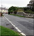
North along David Street, Wick, Vale of Glamorgan
Ahead for the B4265 St Brides Road. The road markings on the left are at the Trepit Road junction.
Image: © Jaggery
Taken: 28 Aug 2019
0.12 miles