1
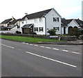
Junction of Llantwit Road and Green Isaf, Wick, Vale of Glamorgan
Viewed across the B4265 Llantwit Road. The dead end road ahead is Green Isaf which is also the name of the large green https://www.geograph.org.uk/photo/6251712 an edge of which is on the right.
Image: © Jaggery
Taken: 30 Aug 2019
0.02 miles
2
Mill Lodge, Wick, Vale of Glamorgan
House on the corner of Llantwit Road and Windmill Close.
Image: © Jaggery
Taken: 30 Aug 2019
0.02 miles
3
Windmill Close, Wick
Residential area of Wick, with the converted Windmill at its end.
Image: © Eirian Evans
Taken: 25 Jun 2021
0.03 miles
4
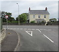
Junction of Windmill Close and Llantwit Road, Wick, Vale of Glamorgan
A triangular Give Way sign faces Windmill Close at the B4265 Llantwit Road junction.
Image: © Jaggery
Taken: 30 Aug 2019
0.03 miles
5
Wick, windmill
Off Llantwit Road; now residential.
Image: © Mike Faherty
Taken: 13 Jul 2016
0.05 miles
6
Windmill tower at the southern end of Windmill Close, Wick, Vale of Glamorgan
Coflein records that this windmill tower dating from 1825 was formerly known as Melin Du. It comprises a tall circular tapering tower of five storeys. There used to be an adjacent barn and kiln with a cart shed. The mill was no longer working in 1890. In 1981 the ancillary buildings were demolished and a modern house was built on the site, incorporating the tower. It is depicted and annotated as Old Windmill on the Ordnance Survey 25 inch County series mapping of 1878. An older windmill tower is nearby. https://www.geograph.org.uk/photo/4632313
Image: © Jaggery
Taken: 30 Aug 2019
0.06 miles
7
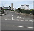
Windmill Close, Wick, Vale of Glamorgan
Cul-de-sac on the south side of the B4265 Llantwit Road. A windmill tower https://www.geograph.org.uk/photo/6251607 is in the background.
Image: © Jaggery
Taken: 30 Aug 2019
0.06 miles
8
Topless windmill, Wick
Image: © Mick Lobb
Taken: 22 Oct 2008
0.07 miles
9
Roadside weather station in Wick, Vale of Glamorgan
Alongside the B4265 in the southeast of Wick.
Image: © Jaggery
Taken: 30 Aug 2019
0.07 miles
10
Llantwit Road semis, Wick, Vale of Glamorgan
Semi-detached houses on the south side of the B4265 Llantwit Road.
Image: © Jaggery
Taken: 28 Aug 2019
0.12 miles


